
This page contains photos of weather related events that have taken place over the years. Modern photos (post 1970) taken by Joe Roberts except where noted.
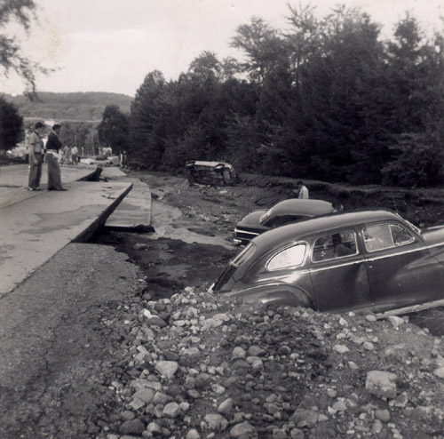
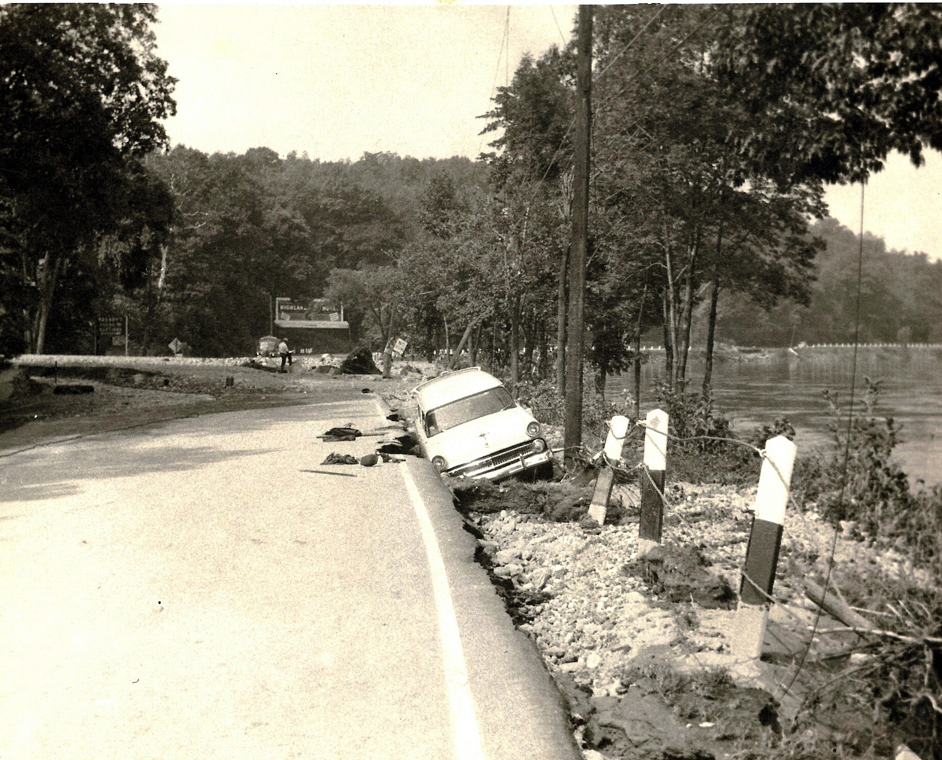 Ford Wagon, 1955 Flood, Rt 20 The contributor of this photo writes This photo shows a mint green brand new 1955 Ford at the curve just East of Bready’s Auction Center (you can see the sign on the left). I remember looking at it and thinking what a shame and how could this of happened to a brand new car. Kind of a lesson everything is up for grabs in a flood. (Photo supplied by Walt Damon)
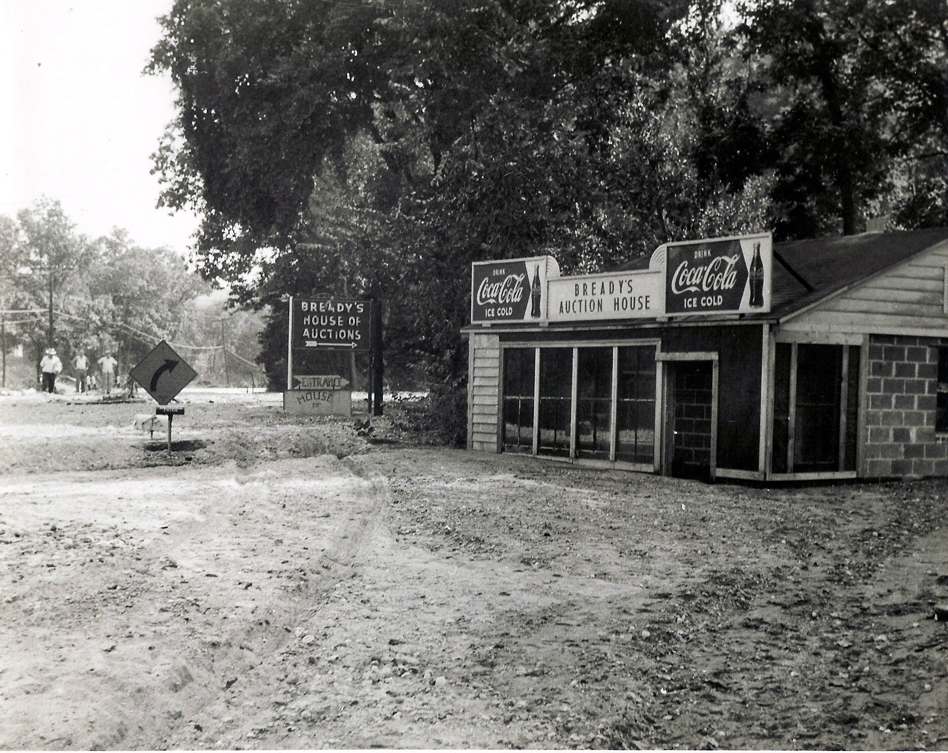 Bait Shop, 1955 Flood, Rt 20 The contributor of this photo writes This photo shows the old Bait & Ice Cream shop that was on Boston Road just West of the current Entrance to the Billiards Hall (the Old Bready Auction Center). It used to serve all the fisherman who would fish in the river sitting on the bank on Boston Road . They took it down after the flood. (Photo supplied by Walt Damon)
 Mountain Rd, 1955 Flood This photo shows the near biblical proportions of the 1955 flood. This is a view of Mountain Road looking to
the north. The Kittredge house is seen just to the right of the center of the photo. Note that there are several people standing along the
left side of what used to be Mountain Road... the gorge that was carved out by the flood waters is just as deep as a person is tall! (Thanks
to Larry for the photo!)
Mountain Rd, 1955 Flood This photo shows the near biblical proportions of the 1955 flood. This is a view of Mountain Road looking to
the north. The Kittredge house is seen just to the right of the center of the photo. Note that there are several people standing along the
left side of what used to be Mountain Road... the gorge that was carved out by the flood waters is just as deep as a person is tall! (Thanks
to Larry for the photo!)
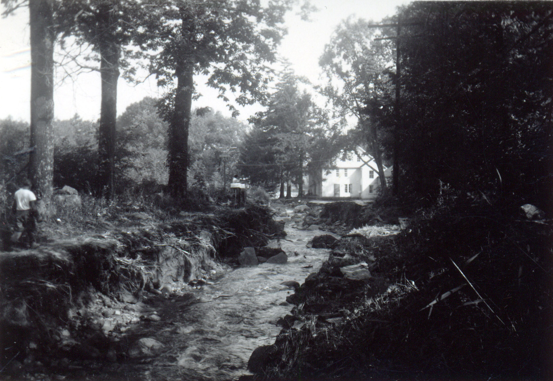
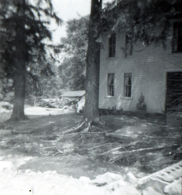
 Kittredge House, 1955 Flood This is a photo of the Kittredge House in the aftermath of the 1955 flood. In looking at this destruction
it is evident (to me anyway) that the large evergreen trees in the front yard very likely saved the house. The roots of the trees held the
soil in place and prevented the erosion from getting to the foundation of the house. Note the dog in the front of the house. There is also
a makeshift bridge in place (a ladder) to cross the stream. (Thanks to Larry for the photo!)
Kittredge House, 1955 Flood This is a photo of the Kittredge House in the aftermath of the 1955 flood. In looking at this destruction
it is evident (to me anyway) that the large evergreen trees in the front yard very likely saved the house. The roots of the trees held the
soil in place and prevented the erosion from getting to the foundation of the house. Note the dog in the front of the house. There is also
a makeshift bridge in place (a ladder) to cross the stream. (Thanks to Larry for the photo!)
 Mountain Rd, 1955 Flood Another impressive damage photo from the 1955 flood. This shot is looking north as seen from the front of the
Kittredge house. (Thanks to Larry for the photo!)
Mountain Rd, 1955 Flood Another impressive damage photo from the 1955 flood. This shot is looking north as seen from the front of the
Kittredge house. (Thanks to Larry for the photo!)
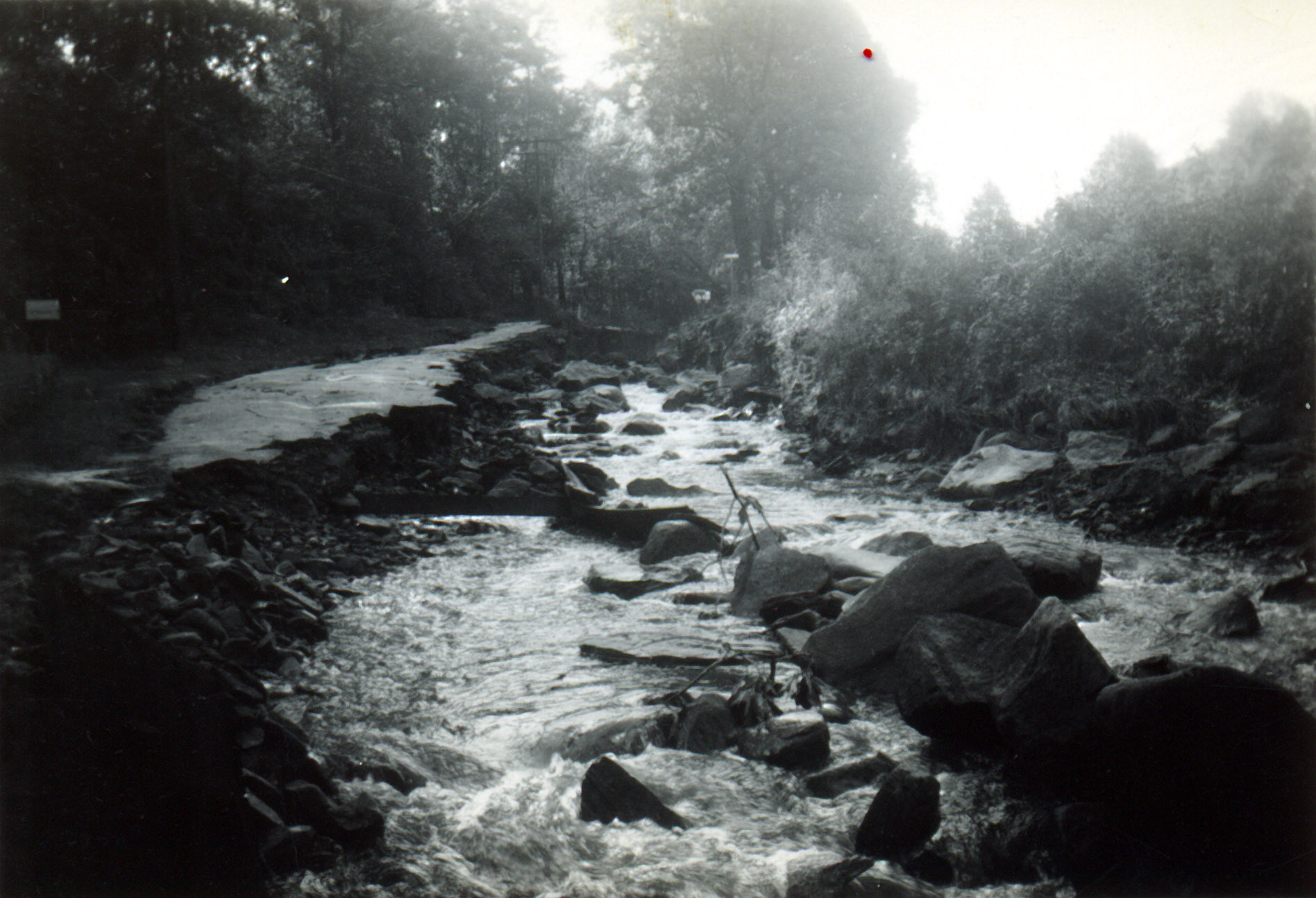
 Mountain Rd, 1955 Flood Here's another truly impressive view of the aftermath of the 1955 flood on Mountain Road. This view is looking
south as seen a little south of where Bartlett Ave connects to Mountain Rd. This shot also shows that in 1955 Mountain Road (before the
flood) was a beautiful rural country road. Note the mailboxes on the right side of (what used to be) the road. Also note the tree that fell
as a result of the erosion and check out the size of some of the boulders in what is now the stream bed! I was not around when this flood
took place, but I can only imagine what the roar of the water must have sounded like. I am told that the highest flood waters came during
the overnight period, this is probably why (so far) no photos of the actual high water have been found. (Thanks to Larry for the photo!)
Mountain Rd, 1955 Flood Here's another truly impressive view of the aftermath of the 1955 flood on Mountain Road. This view is looking
south as seen a little south of where Bartlett Ave connects to Mountain Rd. This shot also shows that in 1955 Mountain Road (before the
flood) was a beautiful rural country road. Note the mailboxes on the right side of (what used to be) the road. Also note the tree that fell
as a result of the erosion and check out the size of some of the boulders in what is now the stream bed! I was not around when this flood
took place, but I can only imagine what the roar of the water must have sounded like. I am told that the highest flood waters came during
the overnight period, this is probably why (so far) no photos of the actual high water have been found. (Thanks to Larry for the photo!)
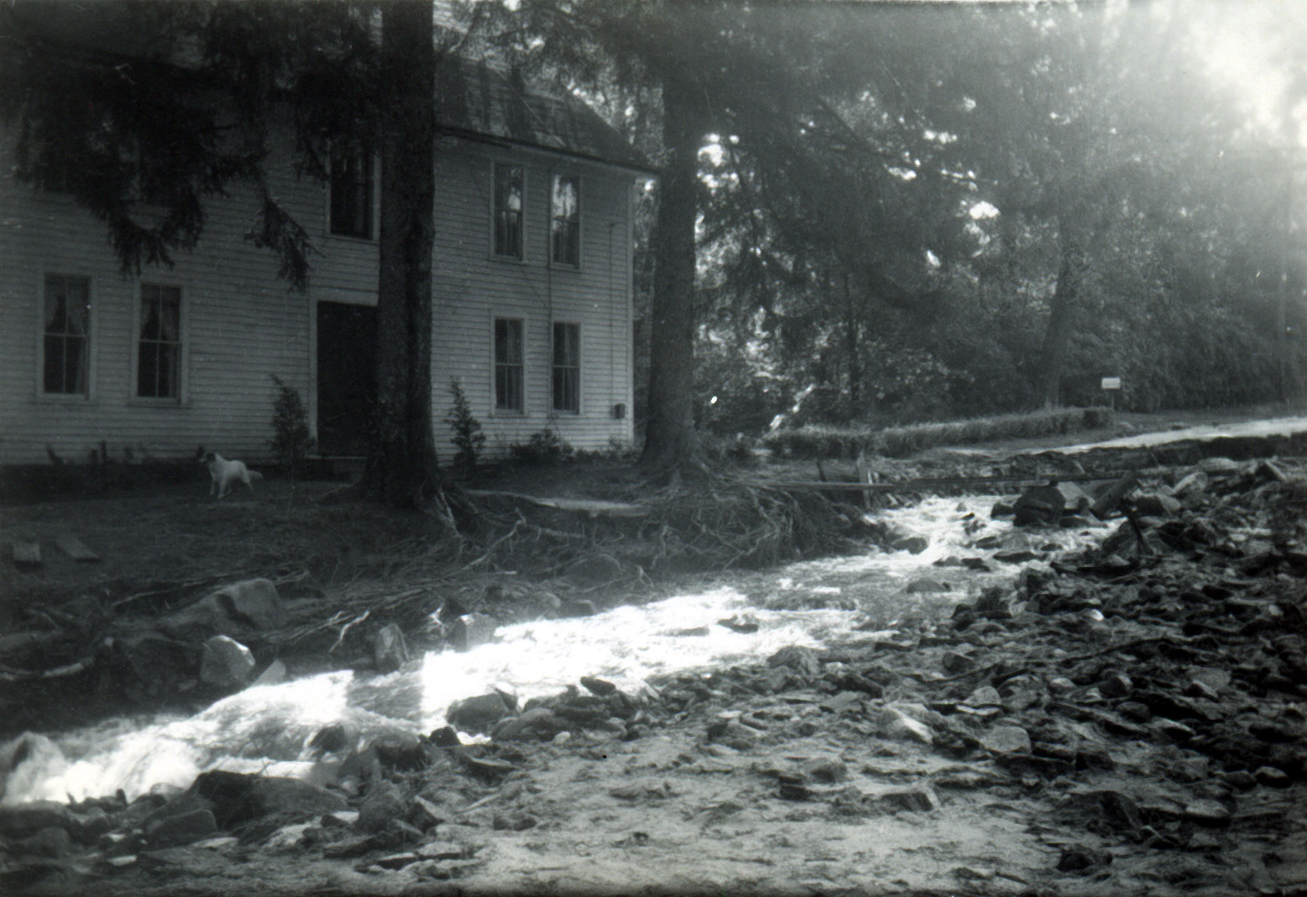
 Kittredge House, 1955 Flood Here's a shot of part of the Kittredge house (looking to the northeast) Part of this photo appears to be
a double exposure. When the flood occurred it jumped out of its banks at around where Danforth Farm Road is today. From there it rampaged
down Mountain Road and then went off the road (back towards its original location) just north of the Kittredge house. The raging waters made
a large gorge across the Kittredge property and apparently washed away a structure (probably a barn) in its path. Note what appears to be a
collapsed structure just to the left of the house in this photo. (Thanks to Larry for the photo!)
Kittredge House, 1955 Flood Here's a shot of part of the Kittredge house (looking to the northeast) Part of this photo appears to be
a double exposure. When the flood occurred it jumped out of its banks at around where Danforth Farm Road is today. From there it rampaged
down Mountain Road and then went off the road (back towards its original location) just north of the Kittredge house. The raging waters made
a large gorge across the Kittredge property and apparently washed away a structure (probably a barn) in its path. Note what appears to be a
collapsed structure just to the left of the house in this photo. (Thanks to Larry for the photo!)
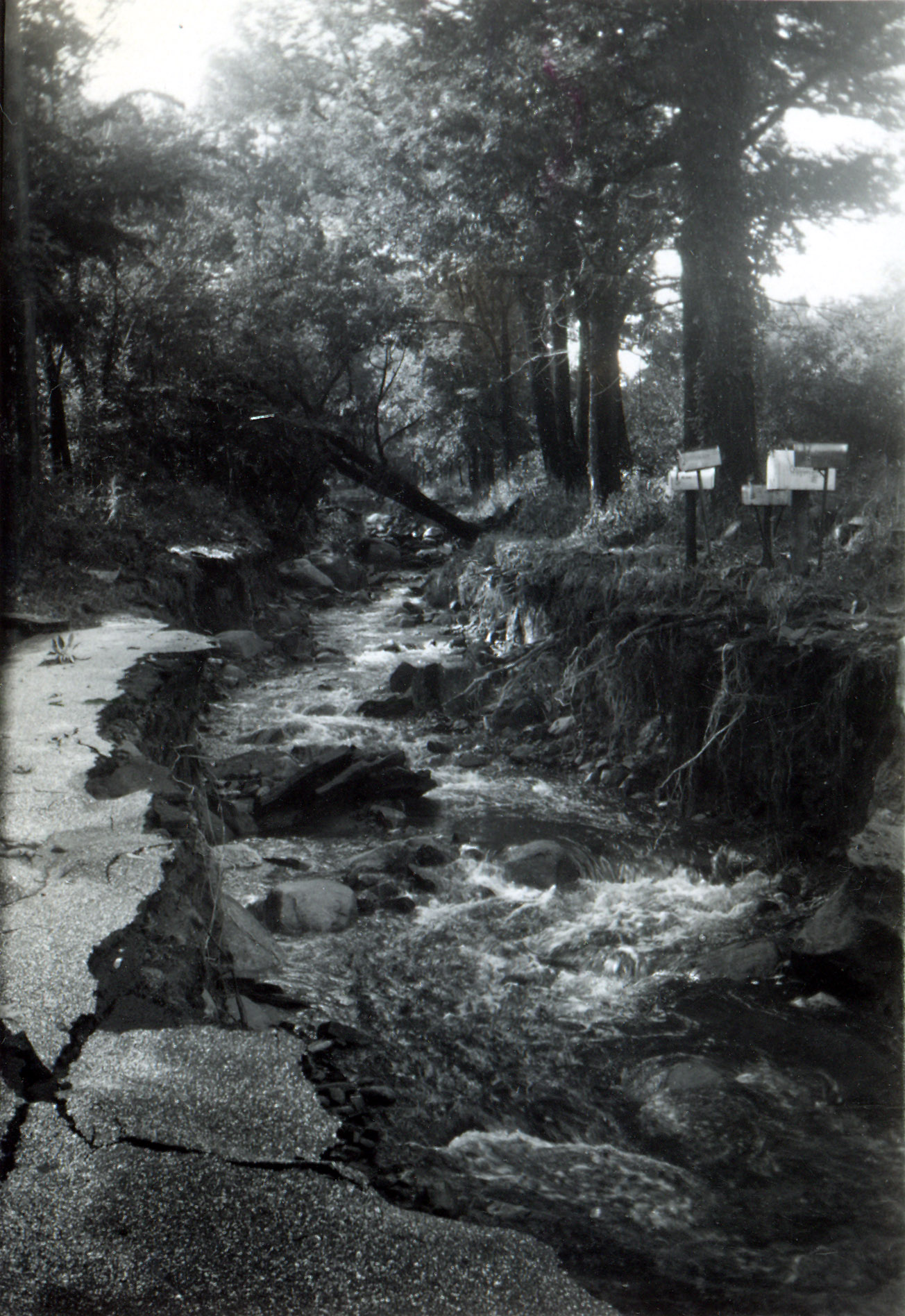
 1955 Flood, Mountain Rd A view of the truly historic damage to Mountain Road as a result of the 1955 flood. This photo looks south along Mountain Rd just south of the Kittredge House. Note the extreme erosion and undermining of the road surface! Some people compared the flooding of 200 to 1955, clearly these two events were in a different class. (Thanks to Larry for the photo!)
 1955 Flood, Mountain Road Another remarkable photo showing the catastrophic damage to Mountain Rd as a result of the 1955 flood. This photo shows that the road has been nearly wiped off the mountain! Note the depth of the gorge and the size of the rocks that are left exposed by this event! (Thanks to Larry for the photo!)
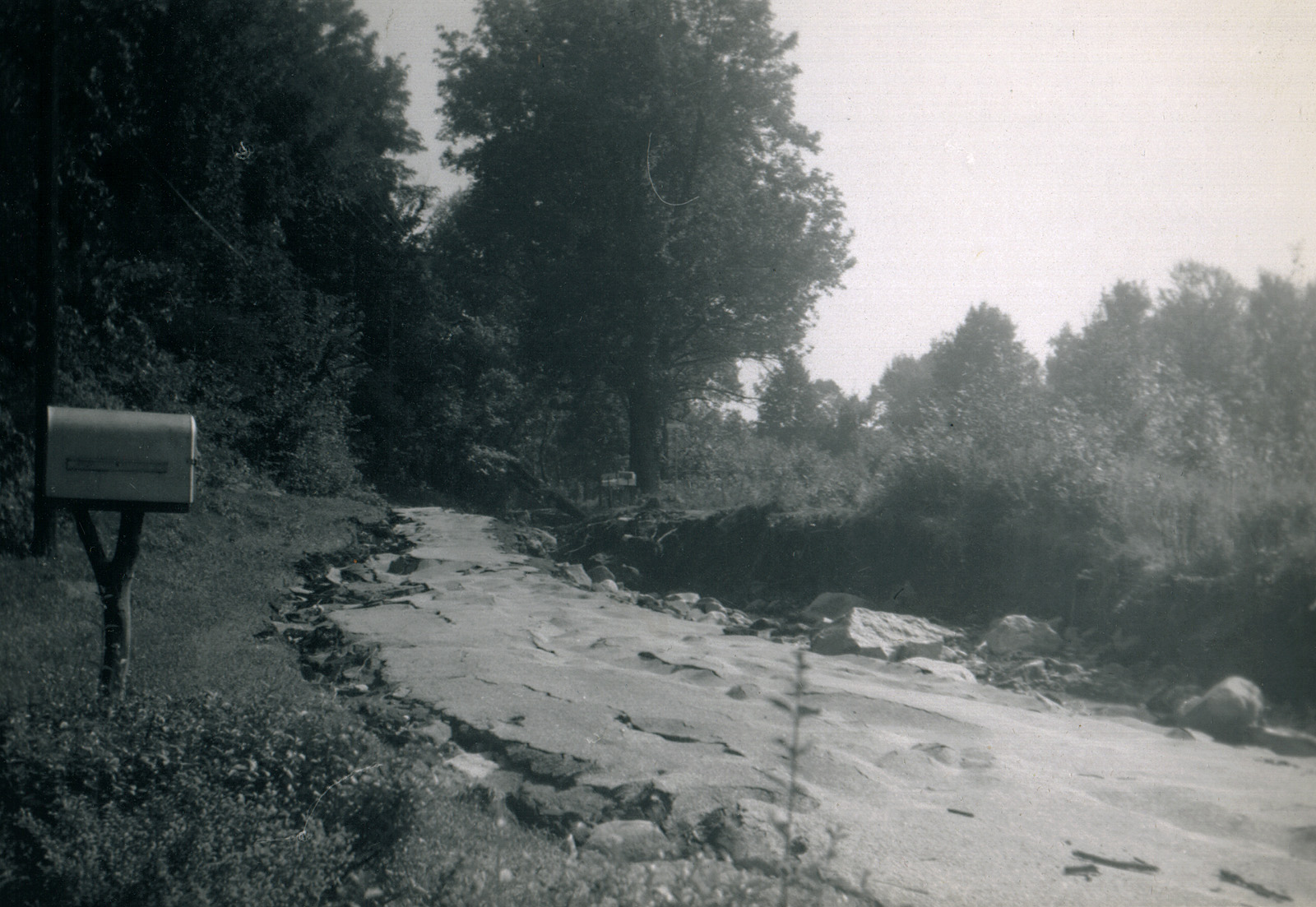
 1955 Flood, Mountain Road A photo that shows the damage to the Kittredge field (just north of the Kittredge house). This photo shows a large ditch where a field used to be! The water (running along the road) chose this point to exit and go back into the stream bed (quite some distance from this area). According to one of the Wilbraham History books, several thousand cubic yards of fill were needed to repair the damage to this area of the mountain. (Thanks to Larry for the photo!)
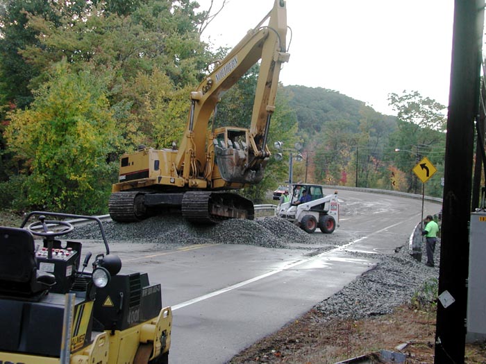 Repairs to Rt 20, 15 October 2005 Heavy equipment making repairs to Rt 20 in the aftermath of the "Flood of October 2005". At least 12" of rain fell between 8 and 15 October, with approximately 6" of rain overnight on 14-15 October. 12 Mile Brook apparently came over the road here, I heard reports of the water being 1 foot deep on the road. A large gully existed on the south side of the road as a result of the flood waters, the large excavator is compacting the fill. A few miles up the road, the underpass at the junction of Rt 20 and 181 had 3 to 4 feet of water in it, and remained closed for at least 2 days.
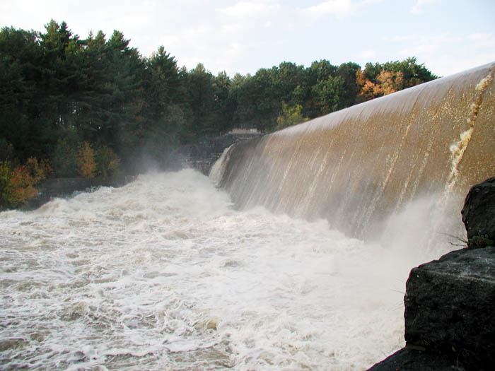
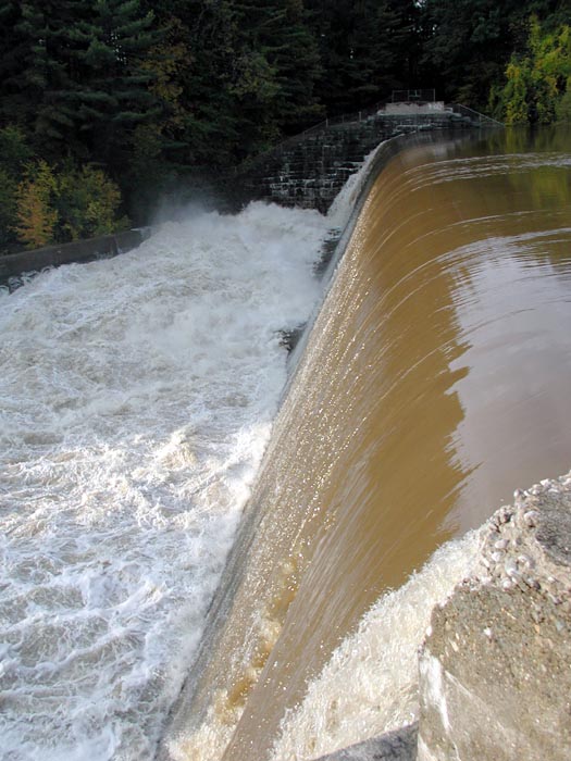 Red Bridge Dam, 15 October 2005 Very high water over Red Bridge Dam at North Wilbraham. The last time I saw the water this high was the spring of 1984. A lot of people visited the dam today, one man from the area stated that his rain gauge overflowed at 7" from the night previous!
 Red Bridge Dam, 15 October 2005 A view of Red Bridge Dam from below.
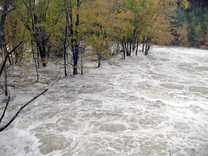 Red Bridge Dam, 15 October 2005 Churning waters below Red Bridge Dam, a place where fishermen often fish. Not today! The places where people fish from are 4 to 5 deep in water when this photo was taken!
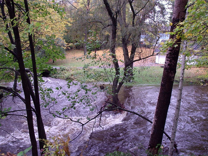
 Mill River at Boy Scout Camp near Stony Hill Rd, 15 Ocotber 2005 The normally 3 foot wide Mill River has swollen significantly today! Photo contributed by Bruce Tingle.
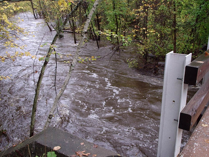 12 Mile Brook, 15 October 2005 A view of the water of 12 Mile Brook on the east side of Crane Hill Road. Photo contributed by Bruce Tingle.
 12 Mile Brook, 15 October 2005 The view from the other side of the road, where 2 brooks merge to one. The water here is far higher than normal! Photo contributed by Bruce Tingle.
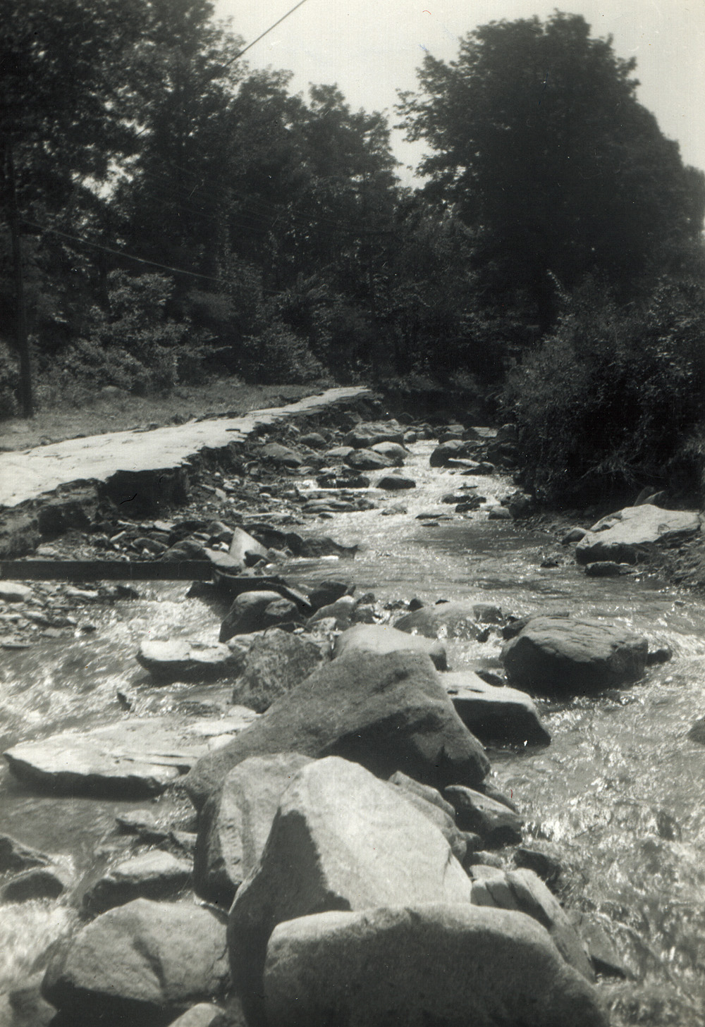
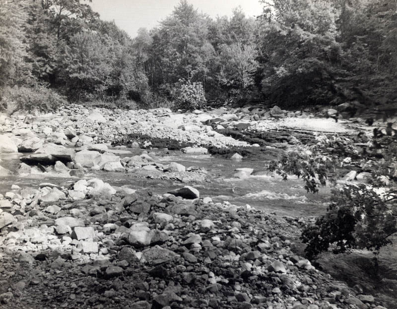 12 Mile Brook, 1955 Flood Not sure exactly where this was taken, however it is an image of part of 12 Mile Brook after the 1955 flood.
 Boston Road, 1955 Flood Some of the tremendous damage caused by the 1955 flood. This shot is actually in Palmer,believe it is looking east towards the underpass (the one where the rail tracks go overhead).
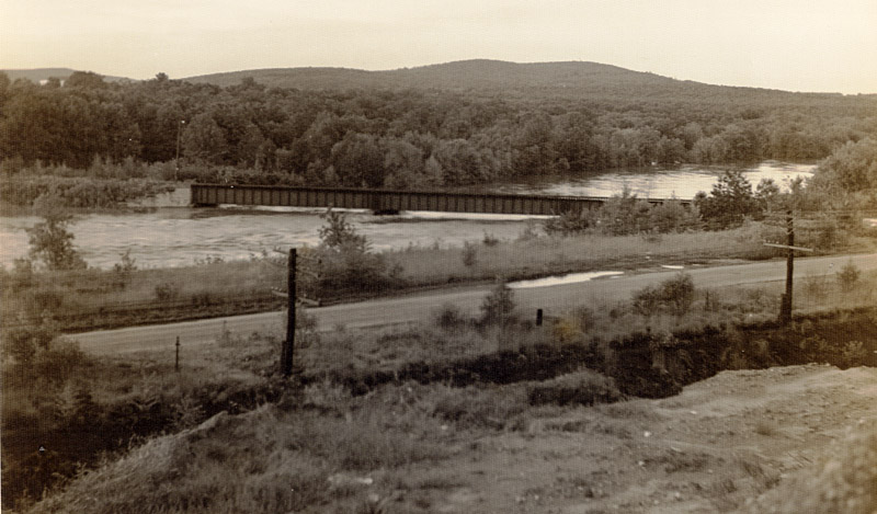 Train Bridge, 1955 Flood A view of the railroad bridge that crosses from Wilbraham to the Ludlow Mills complex. This shot was taken from about where Horizons restaurant now stands. Anyone who is familiar with this bridge knows that this photo shows extremely high water! Normally it is quite a drop from the bridge to the water level...
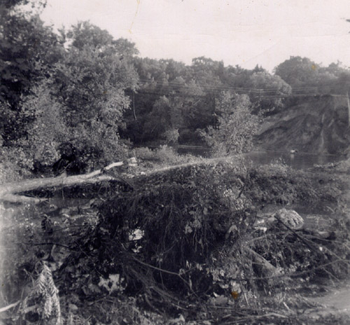 Railroad Washout, 1955 Flood This is a shot of the washed out railroad tracks along Rt. 20 (note the tracks and power lines dangling in air). The dam for Collins Mill (upstream on 12 Mile Brook failed; the torrential flood of water and debris clogged up the culvert, causing a massive backup of water in the valley and eventual failure of the embankment. Thousands of cubic yards of material were needed to rebuild this area in the aftermath.
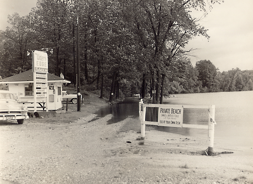 Nine Mile Pond Food Stand Believe this photo shows the aftermath of the 1955 flood... note the water level of the pond (up and over the road that circles around part of the pond). Although it is not discernable in this web quality photo, the sign lists "Sealtest" ice cream, including 10 flavors, "Double Dip Sundaes", "Giant Milkshakes", sandwiches and hamburgers. Also, the sign on the side of the building shows a price of $1.15 for a half gallon of Sealtest ice cream!
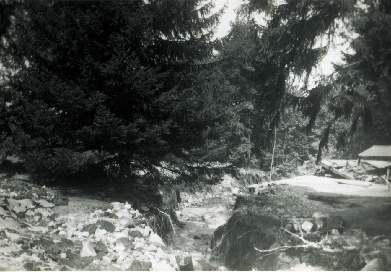
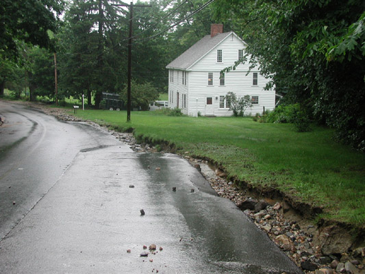 June 2000 Flood Some serious erosion on Mountain Rd. in front of the Kittredge house. The last time that the water was higher than this was during the 1955 flood. This part of Mountain Road has a history of washout problems due to the manner in which the stream parallels and crosses the road (complicated by the huge volume of water that the Wilbraham Mountain can channel to this area). Road improvements in 2002 should help to prevent washouts from all but the most severe storms.
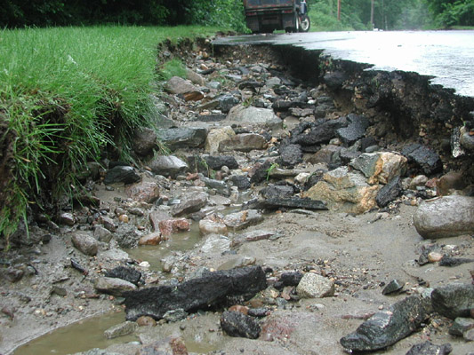 June 2000 Flood Another view of the road damage resulting from the flood waters in June 2000.
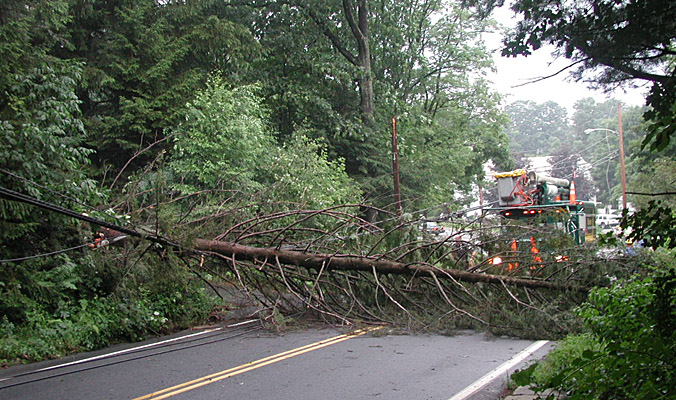 4 July 2002 Thunderstorm Some violent thunderstorms hit the Wilbraham area in the late afternoon of July 4, 2002. Some of the storms had hurricane force winds, resulting in damage typical of that shown here. This large tree (downed just up the hill from Grace Union Church) caused a good part of Wilbraham Mountain to be without power for about 10 hours.
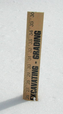 Deep Snow: 6 Feb 2001 A snowstorm on 6 February 2001 dumped about 18 inches of snow on an already significant base. Here is a measurement (using a yardstick) of the typical snow depth!.
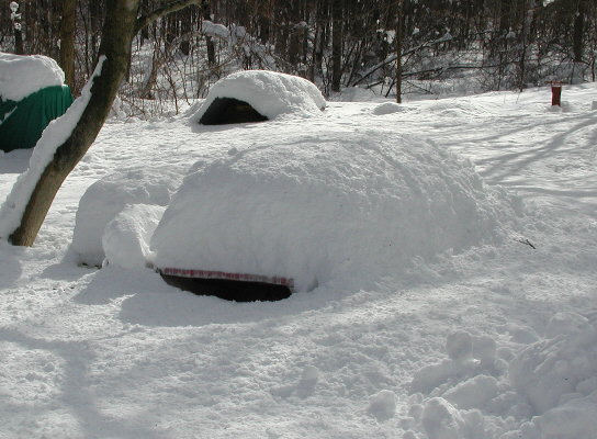 Deep Snow: 6 February 2001 This shot of a picnic table in the backyard gives an idea of the depth of the snow on this date. As can be seen, the snow depth is just about even with the table surface.
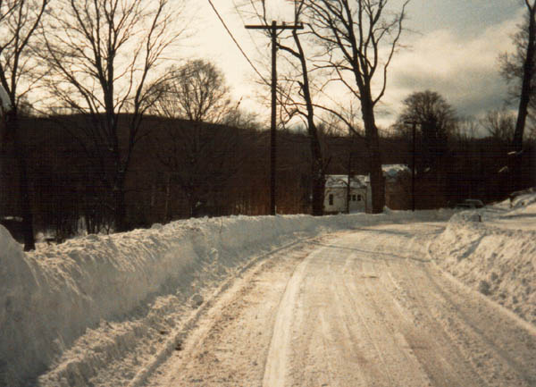 Deep Snow Back when we had "real winter" with significant amounts of snow. Note here that the snow banks on the roadside are up to the level of the mailboxes!.
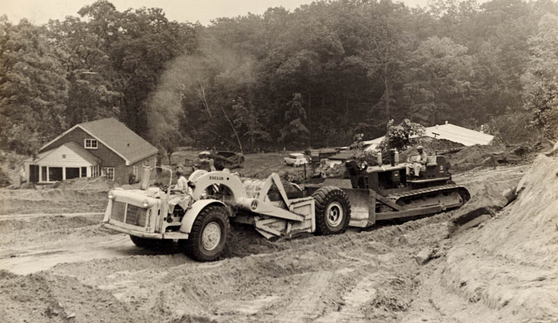
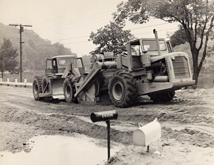 Road Repair after '55 Flood Heavy equipment making repairs to Rt 20 after the washout caused by the 1955 flood.
 Road Repair after '55 Flood Heavy equipment making repairs washout caused by the 1955 flood. Believe this photo shows work being done on Crane Hill Rd.
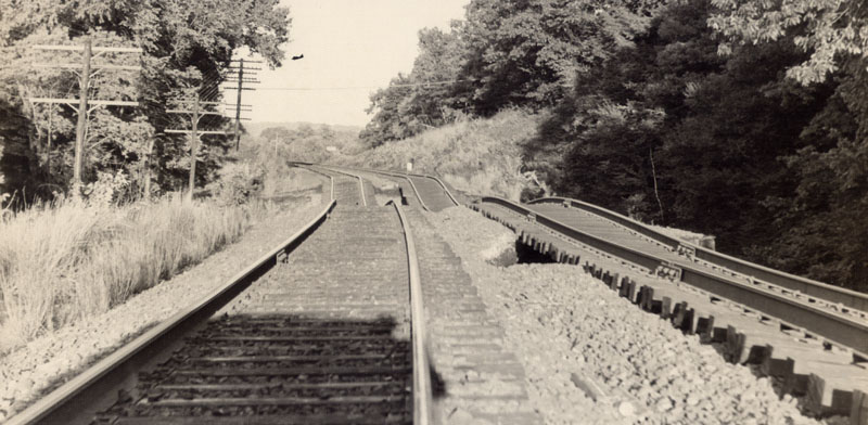 Flood Damage to Railroad Tracks Damage to the railroad tracks (along Rt 20) as a result of the 1955 flood.
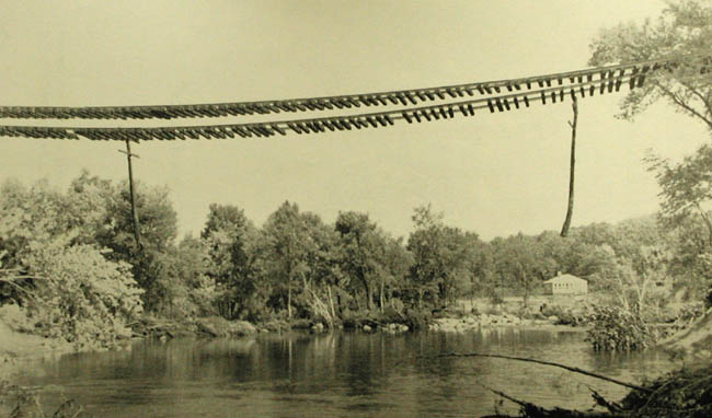 Railroad Tracks left Hanging This shot gives some idea of the magnitude of the disaster caused by the 1955 flood. In addition to the tracks, note the utility poles hanging along side the tracks!
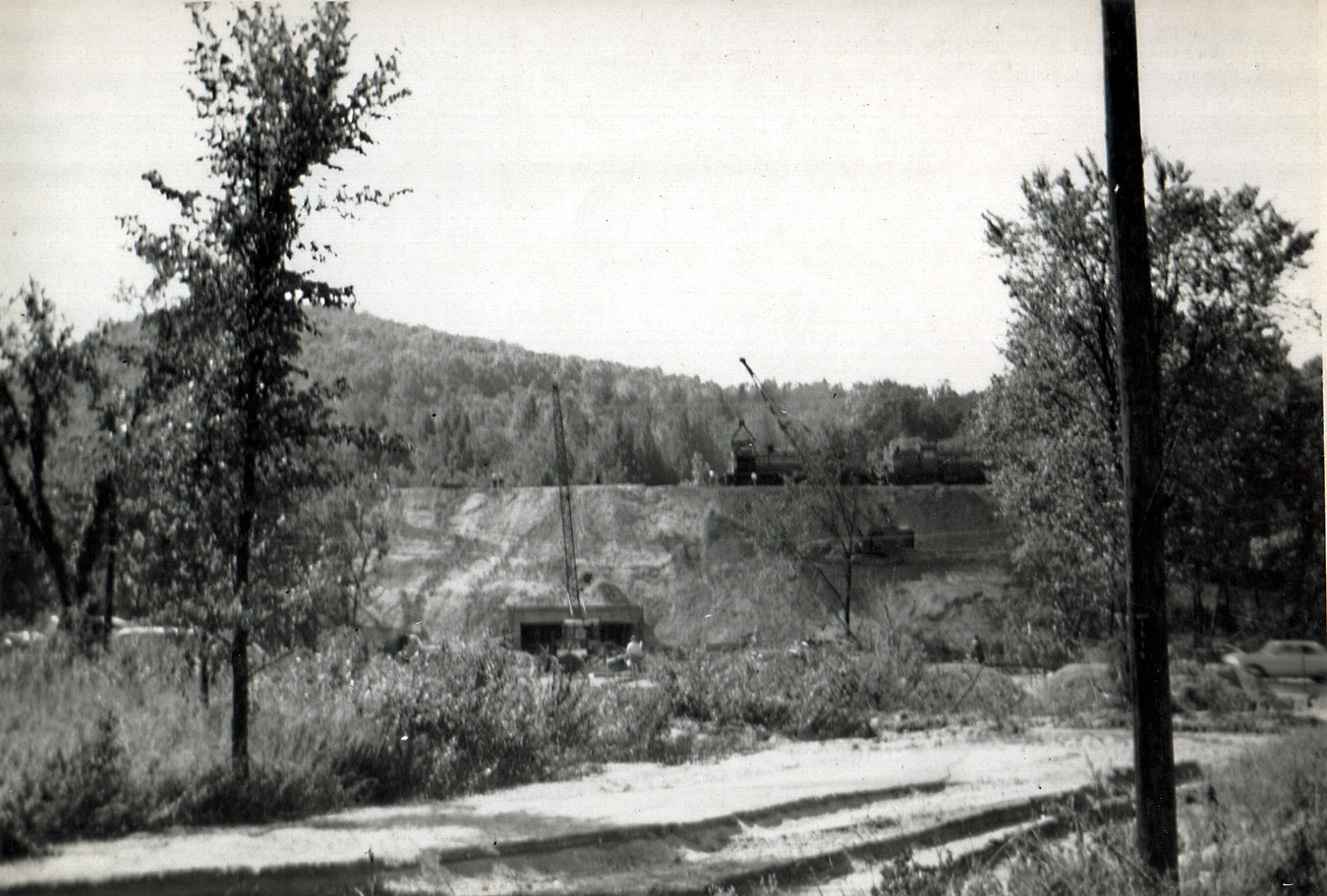
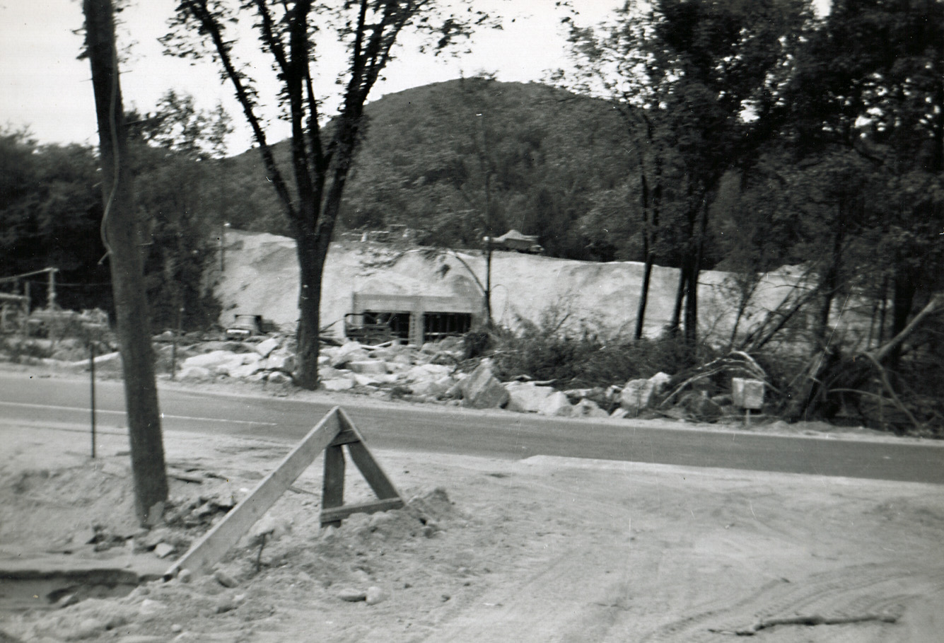 Track Repair in Aftermath of 1955 Flood A view of the partially completed track repairs after the major washout from the 1955 flood. The new concrete sqaure culvert remains in place today. I have heard stories (but have no confirmation) that much of the fill needed for this repair came from excavation from the Mass Pike (which was under construction at this time).
 Track Repair in Aftermath of 1955 Flood Another view of ongoing work to repair the railroad tracks along Rt 20.
 Track Repair in Aftermath of 1955 Flood Another view of ongoing track work. The caption on the back of this photo indicates that the two diesel locomotives were the first to test out the new tracks.
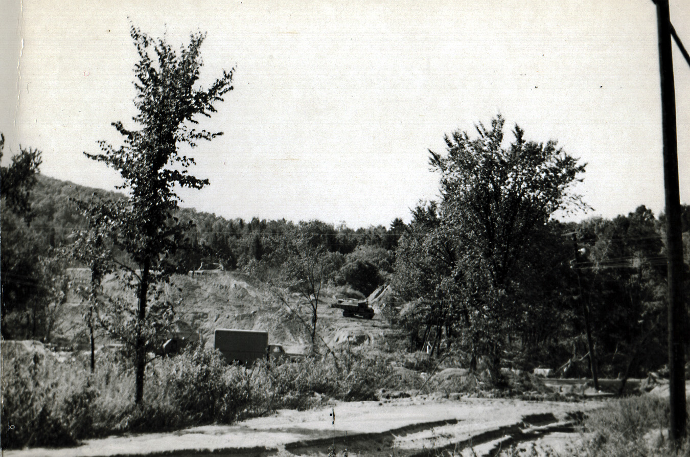
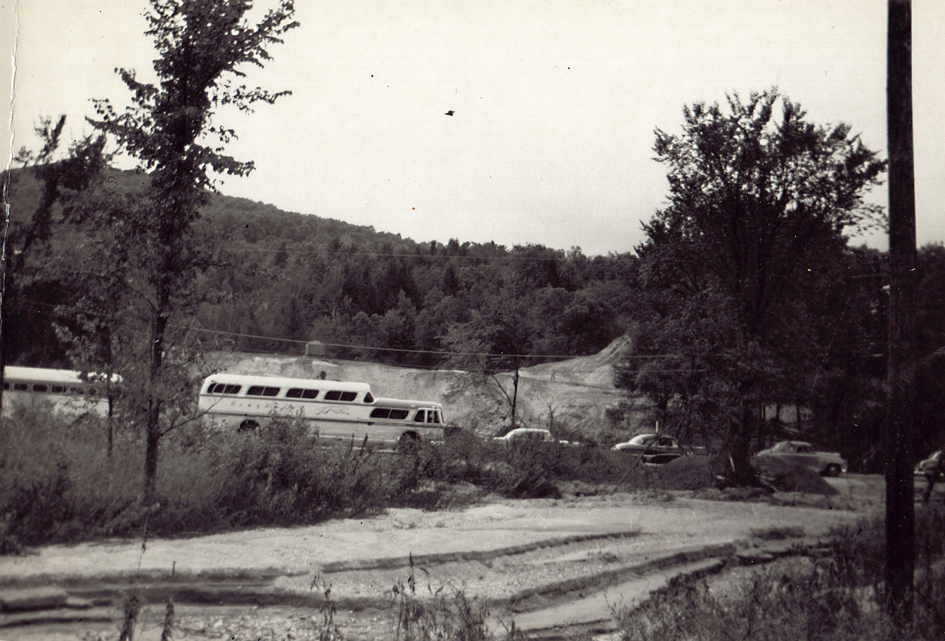 Track Repair in Aftermath of 1955 Flood Autos and an old (by today's standards) bus parked along Rt 20 during track reconstruction.
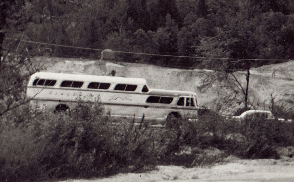 Track Repair in Aftermath of 1955 Flood A zoom on the bus shown in the above photo.
 Track Repair in Aftermath of 1955 Flood Another view of the first locomotives to test the new tracks.
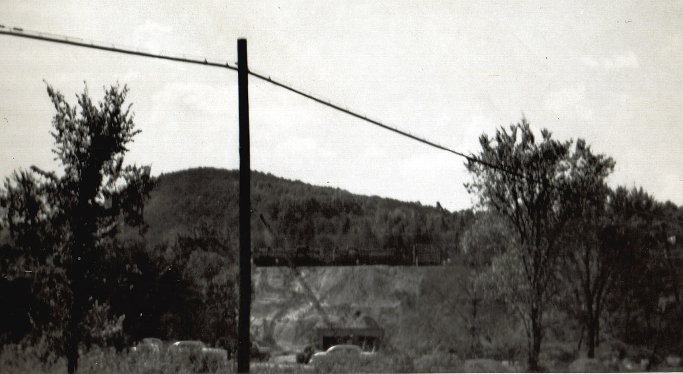
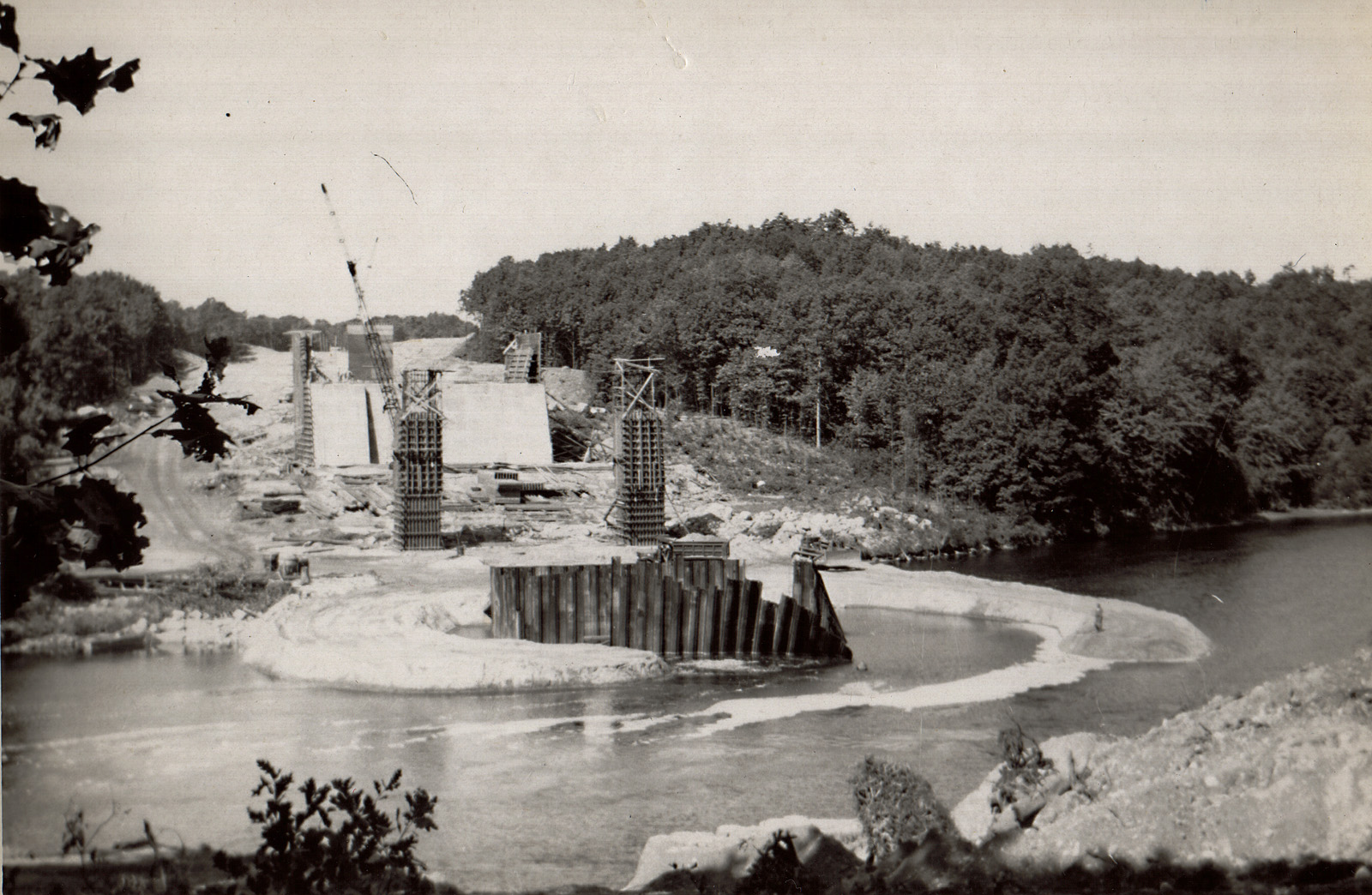 Track Repair in Aftermath of 1955 Flood A view of the construction of the bridge for the Mass Pike that was to cross the Chicopee River. This was taken after the 1955 flood. The caption on the back of the photo states "bent steel members from flood". If you look at the steel in the center of the river it is clear that the upstream ones are bent pretty badly, presumably caused by the raging floodwaters. The dirt roads built up around this construction were almost certainly constructed after the flood (they would never have survived the raging torrent). Note the man standing at the end of the dirt path at the lower right corner of the photo.
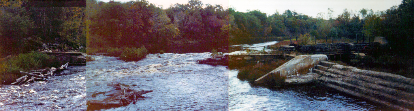 Chicopee River Dam, October 1979 Ok, I know, this is a crude panorama... it's the best I could (without spending a ton of time on it). The original photos are from a 110 camera and they were not taken from the same location on the bridge, making a good panorama not too practical. In any event, this shot shows roughly what the old (ruined) Chicopee River Dam looked like (before the current modern dam and power station was built). This shot was taken during relatively high water in October 1979.
As most who live here know the winter of 2010-2011 (not yet over) has been remarkable. Below are some photos (shot from inside a car while riding as a passenger) on a trip from Mountain Road down to Papa Gino's on Boston Road and back. I've been in town since 1965 and the snow depth is probably the most I have ever seen. All photos taken 03 February 2011.
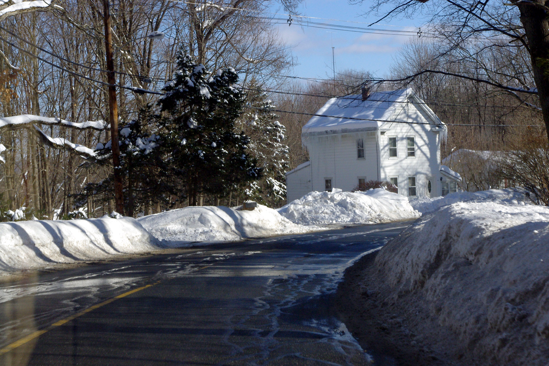
 Winter 2010-2011 The Searles house (just below Glendale on Mountain Rd.
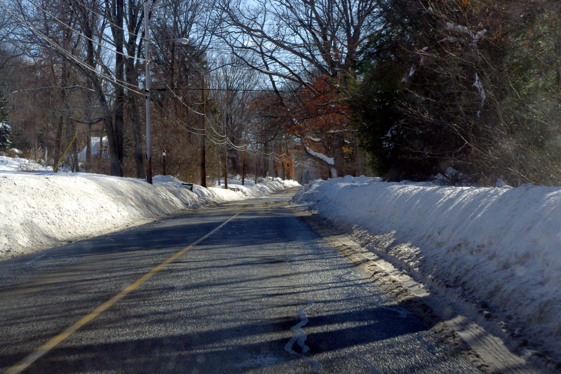
 Winter 2010-2011 Looking down Mountain Road from a little below Glendale Rd.
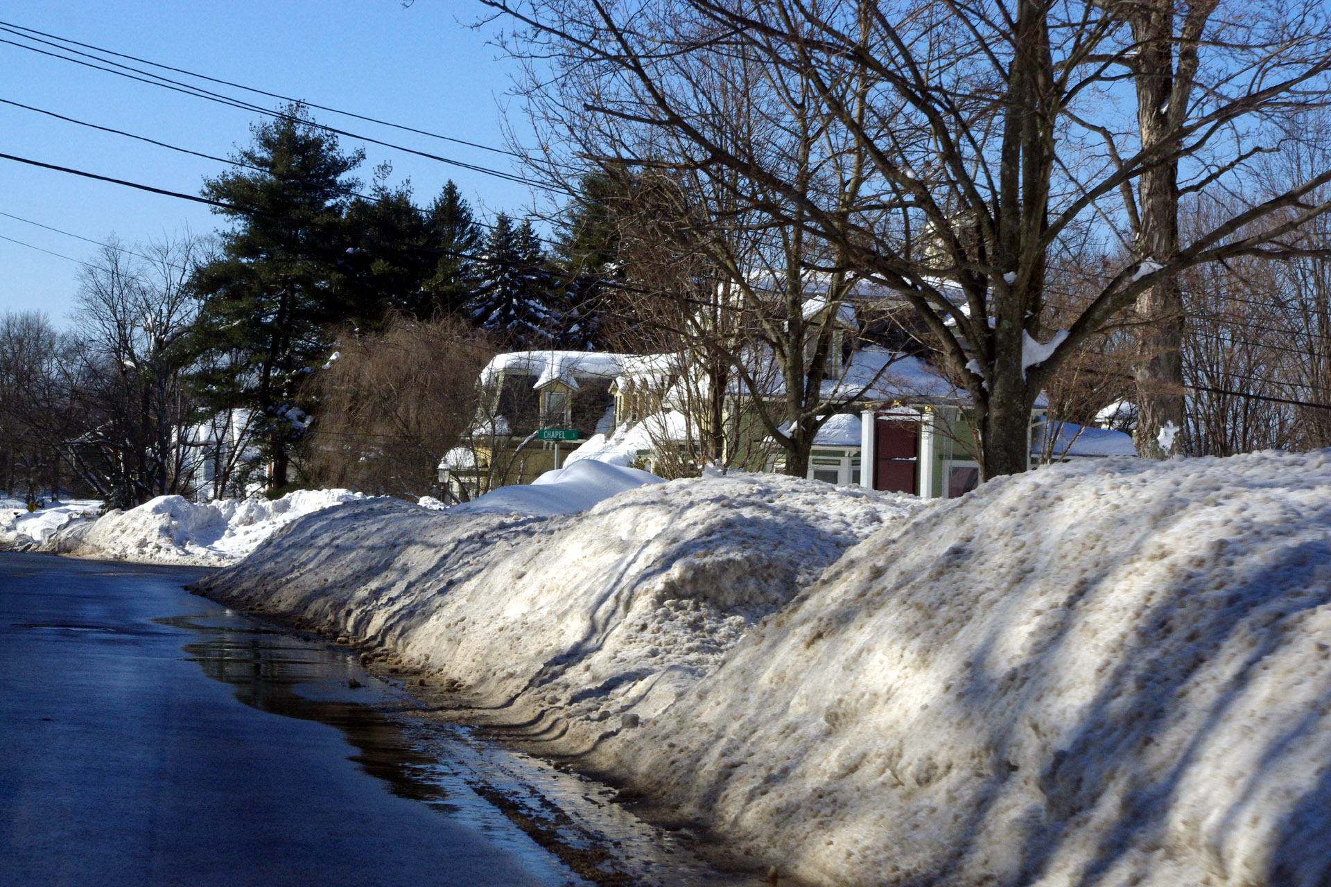
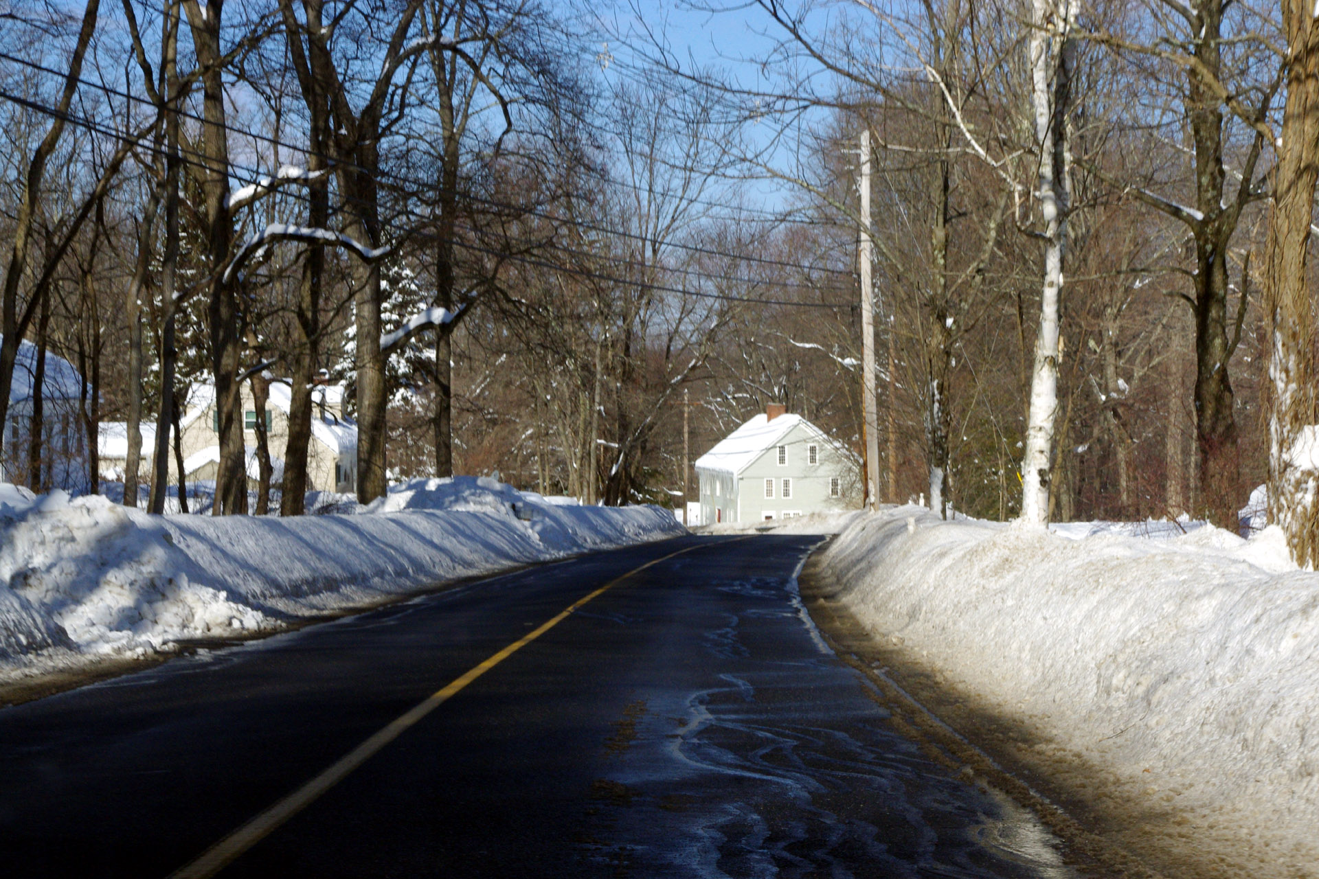 Winter 2010-2011 Looking down Mountain Road from in front of the Danforth house.
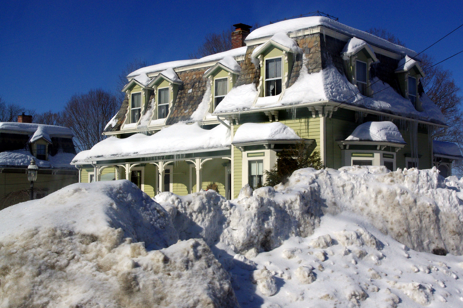
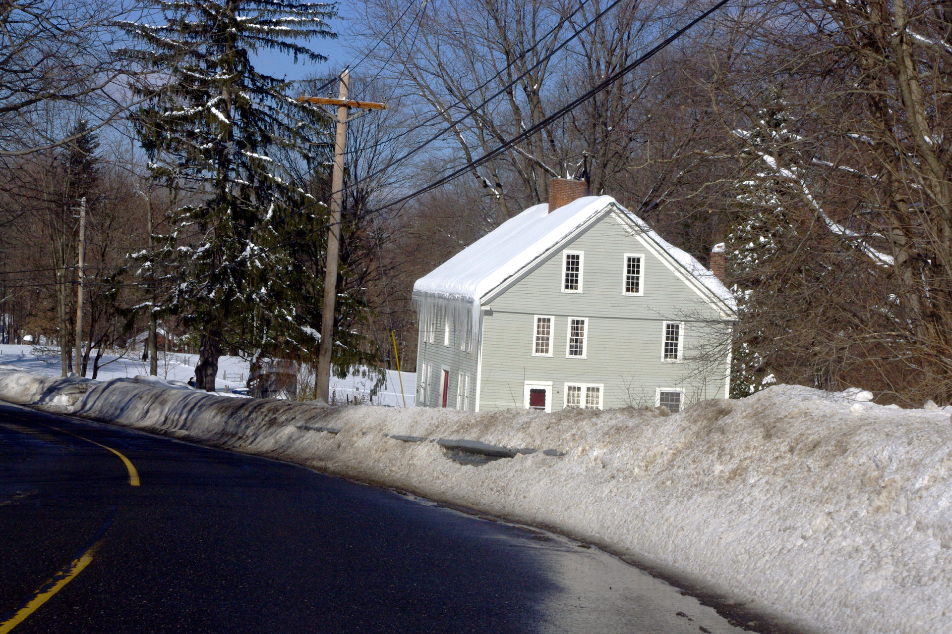 Winter 2010-2011 The Kittredge house.
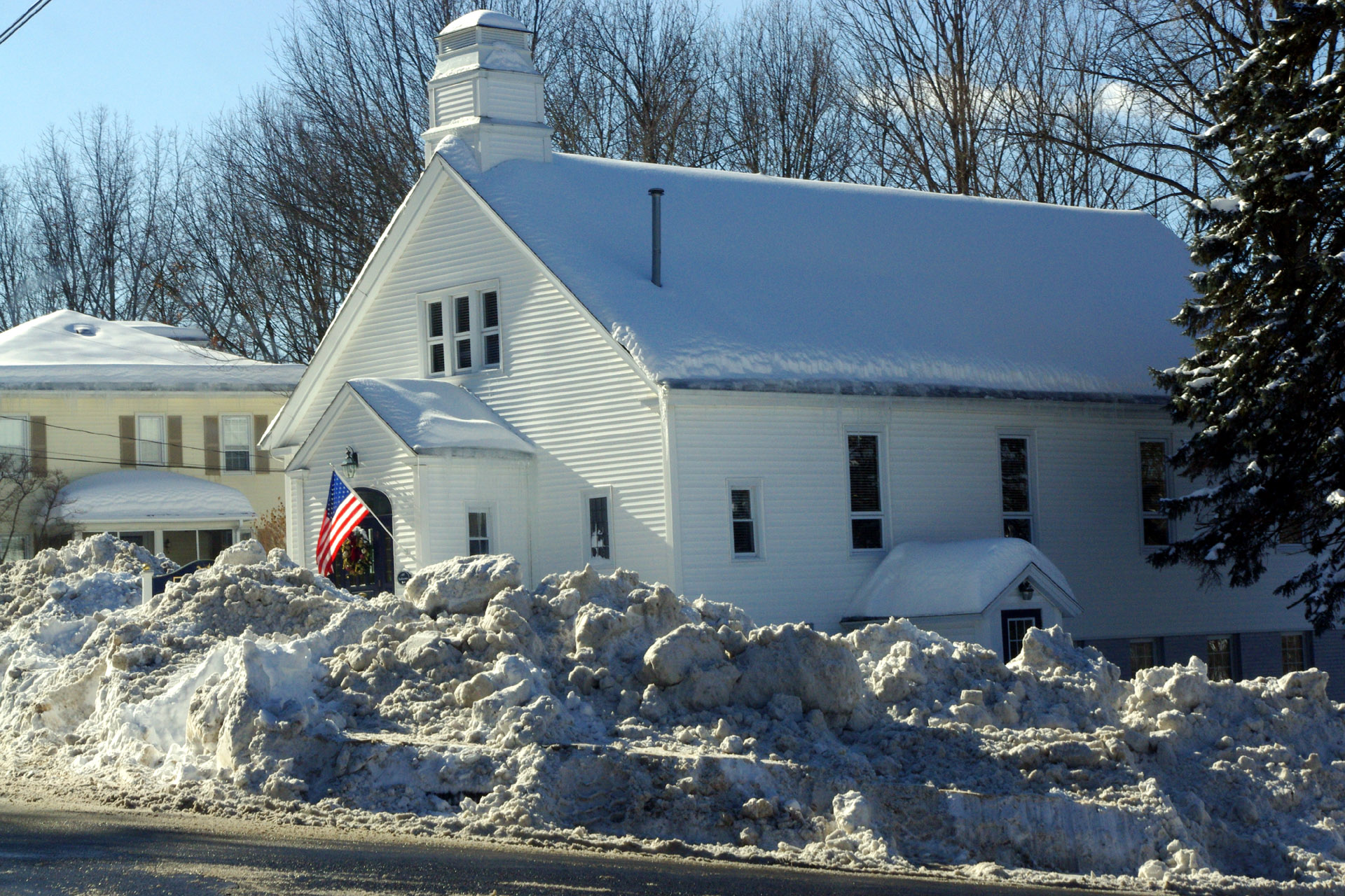
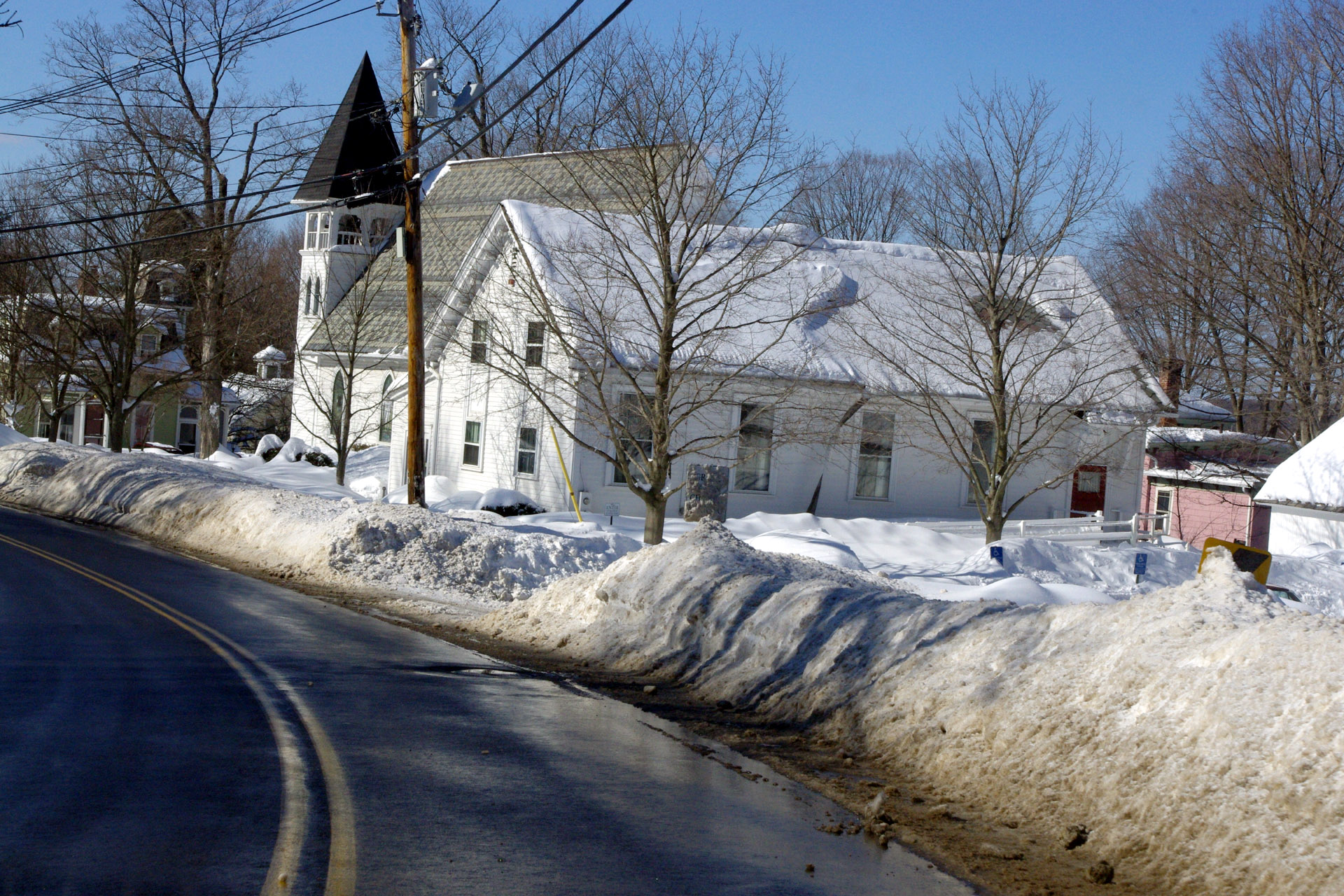 Winter 2010-2011 Grace Union Church as seen from the "S" curve.
 Winter 2010-2011 Snow banks in front of Grace Union Church.
 Winter 2010-2011 Snow piles in front of the Whitehill house on Maple St..
 Winter 2010-2011 A view of the NEPM building.
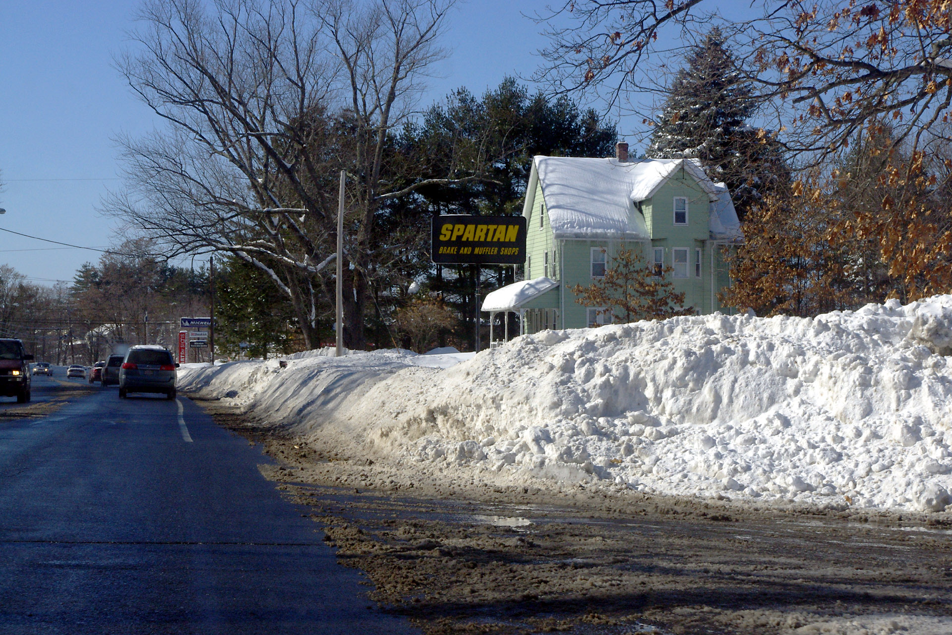 Winter 2010-2011 Snow banks in front of Spartan.
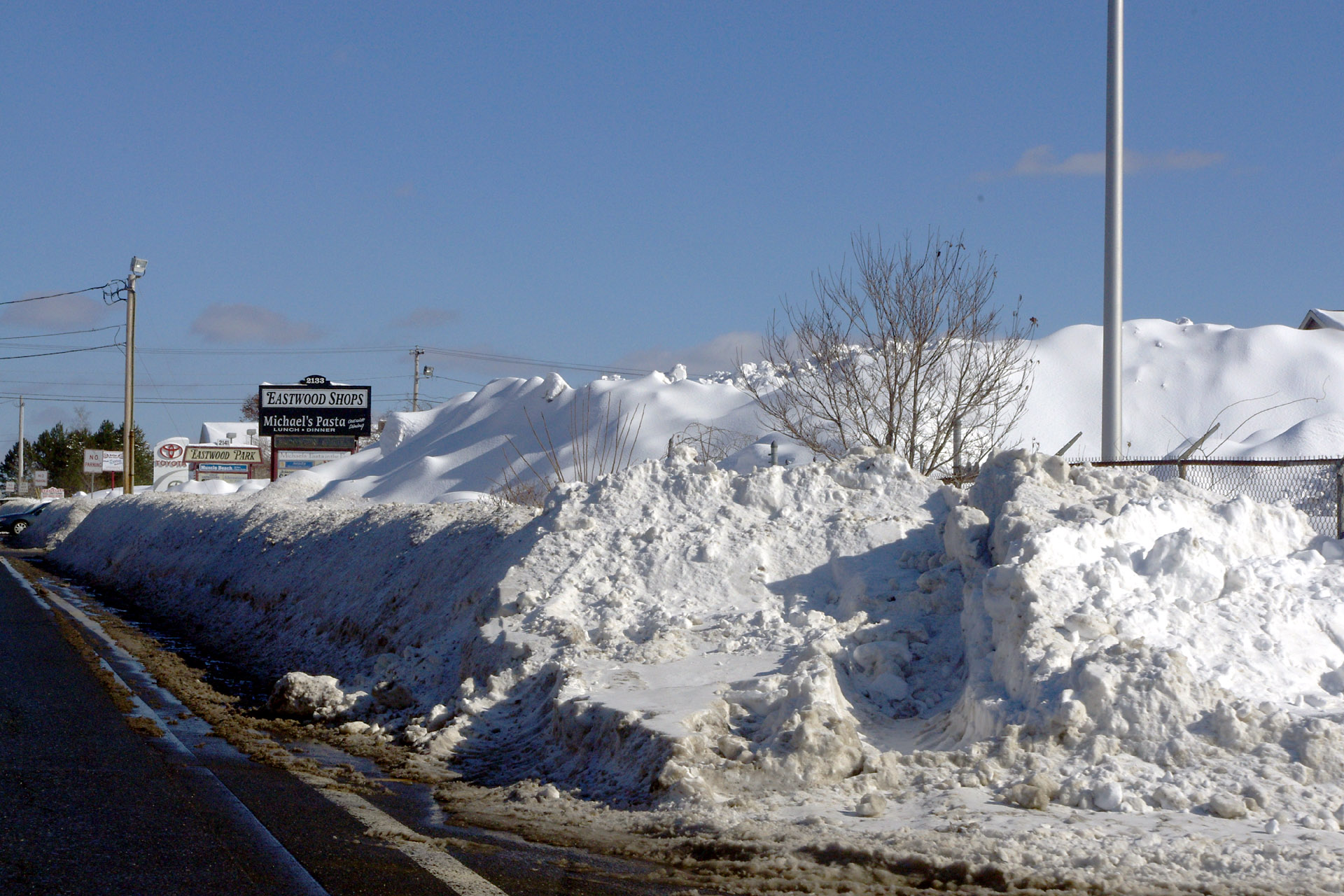
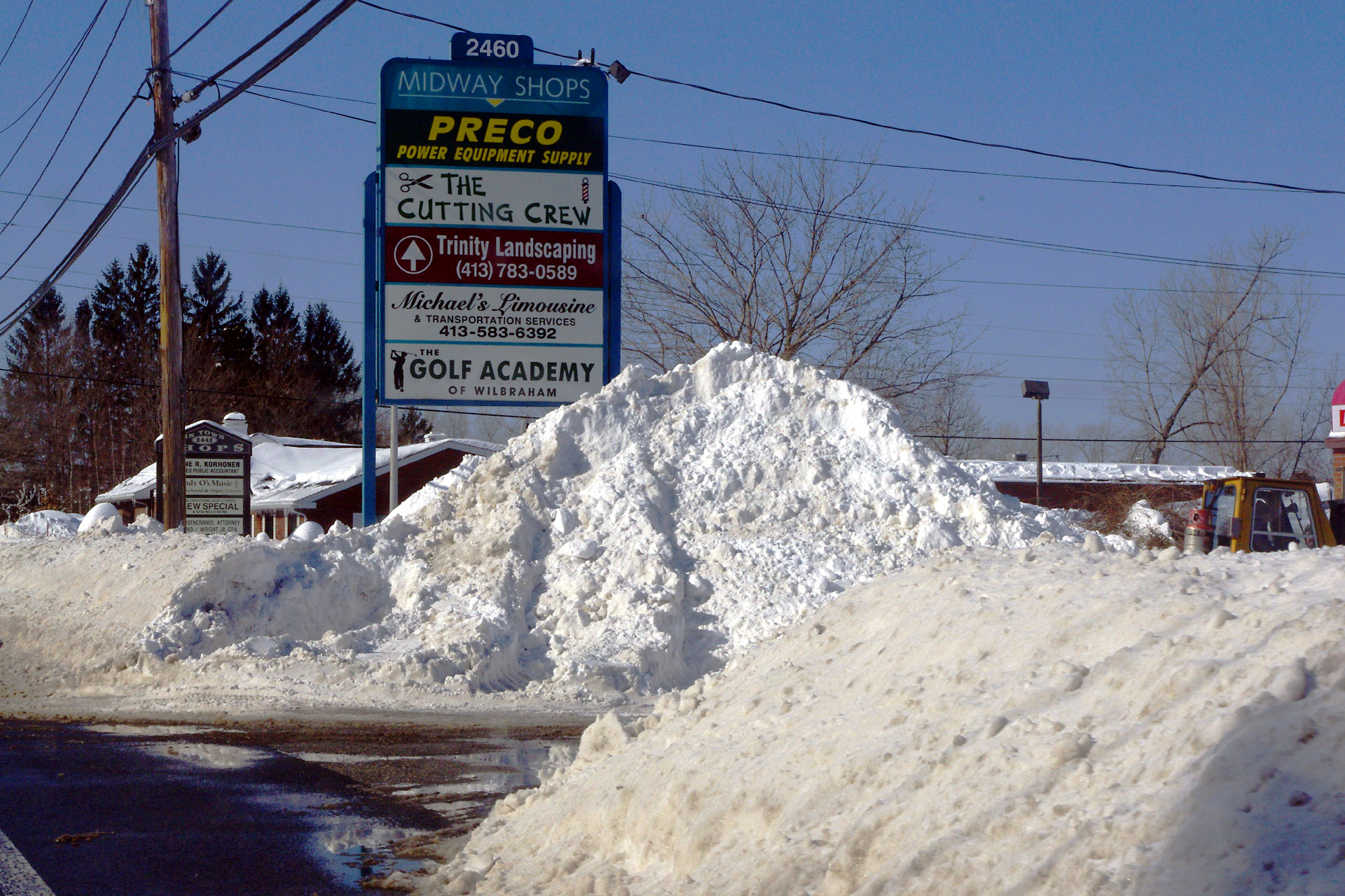 Winter 2010-2011 Snow Mountain in front of Preco.
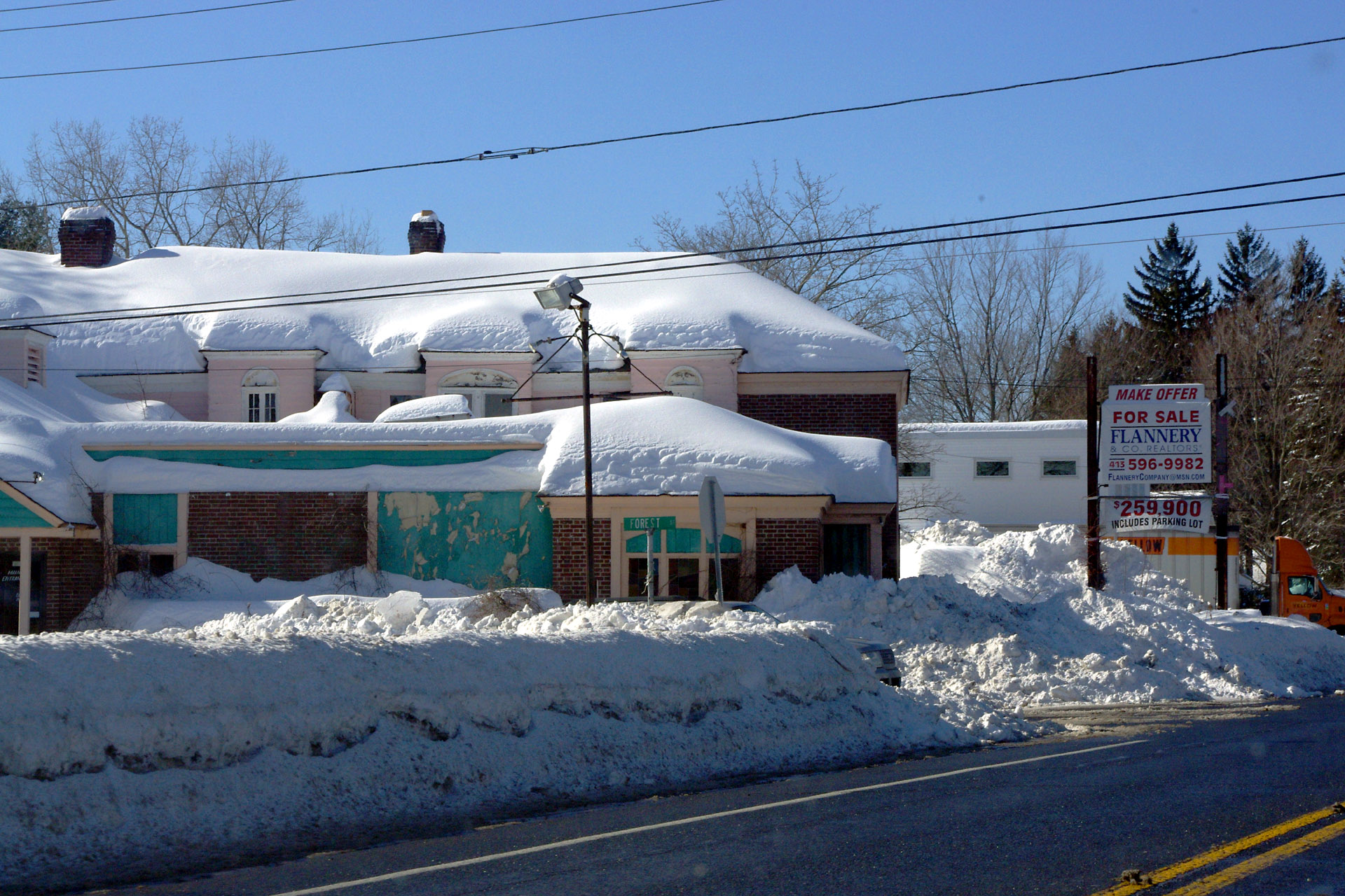 Winter 2010-2011 The old Ground Round building.
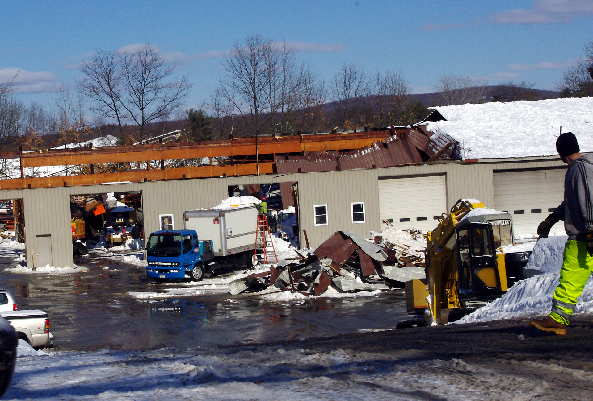 Winter 2010-2011 Aftermath of the roof collapse at WAS Construction.
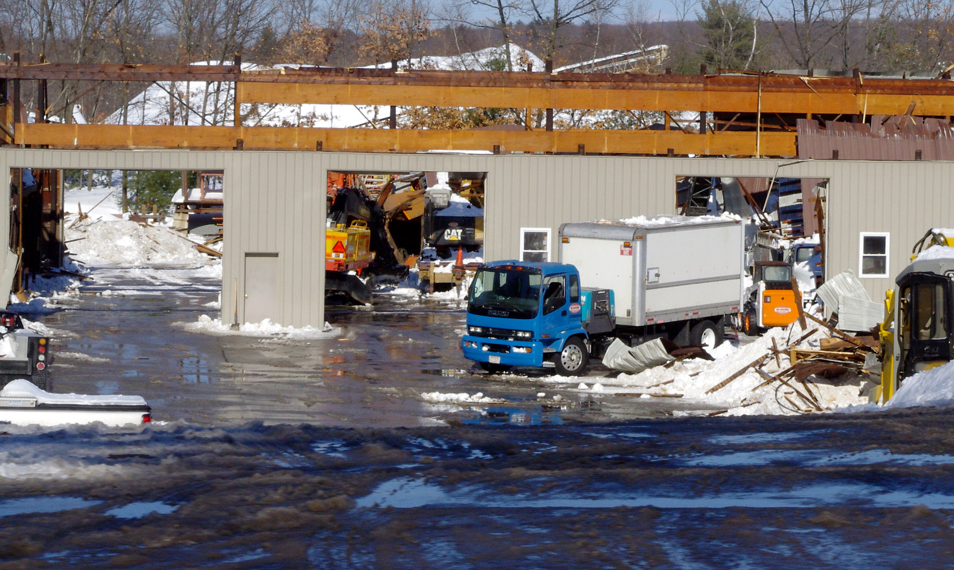 Winter 2010-2011 Aftermath of the roof collapse at WAS Construction.
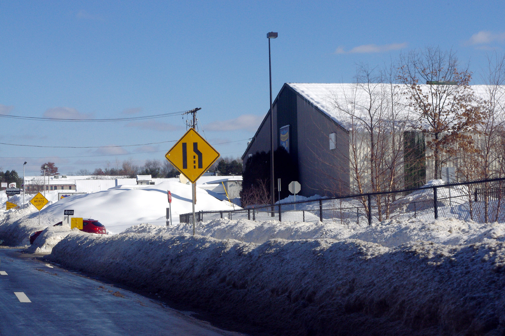
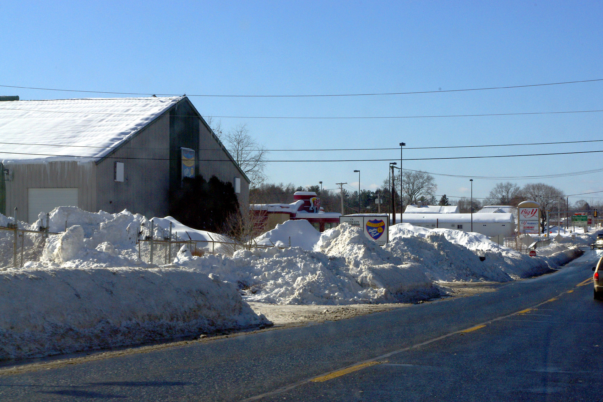 Winter 2010-2011 A view of Interskate 91.
 Winter 2010-2011 Snow banks in front of Subway.
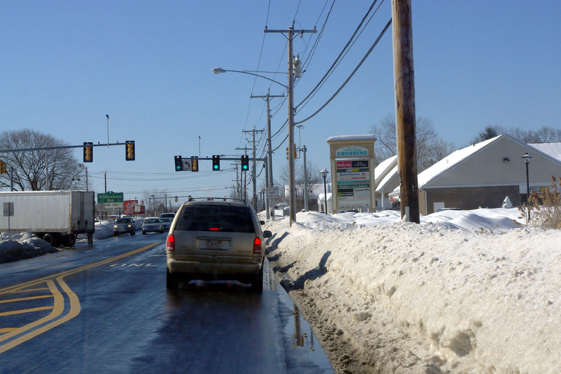
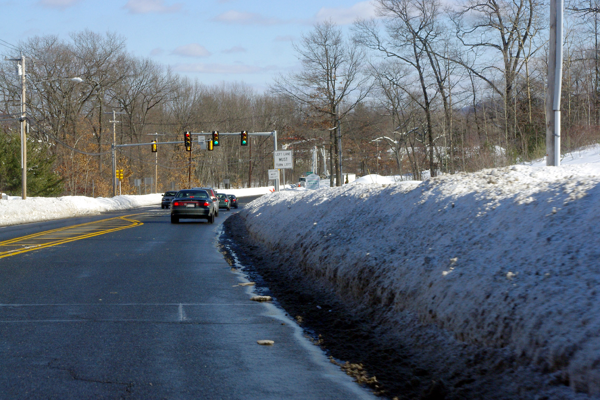
 Winter 2010-2011 Looking east on Boston Rd near the Stony Hill intersection.
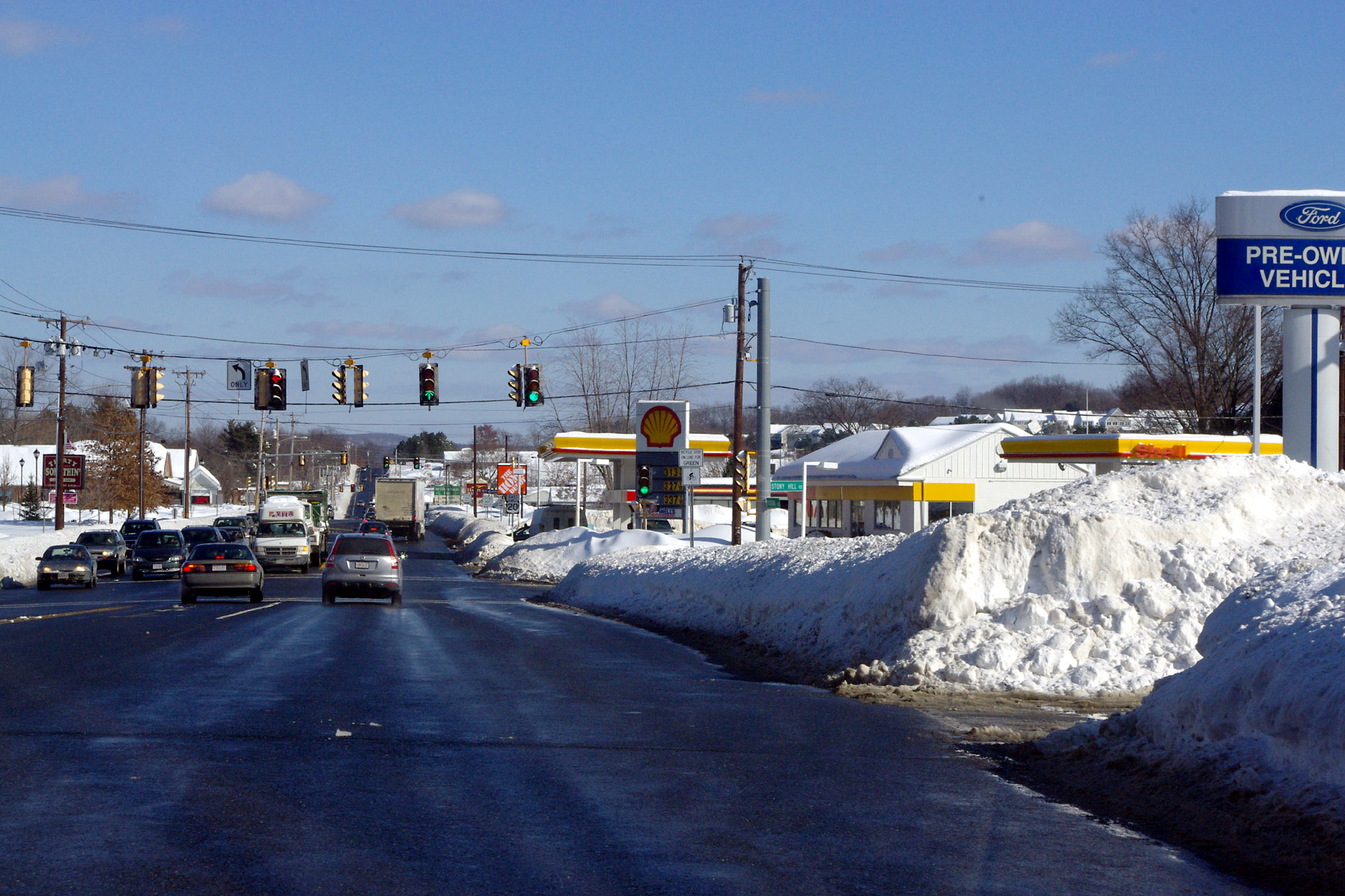
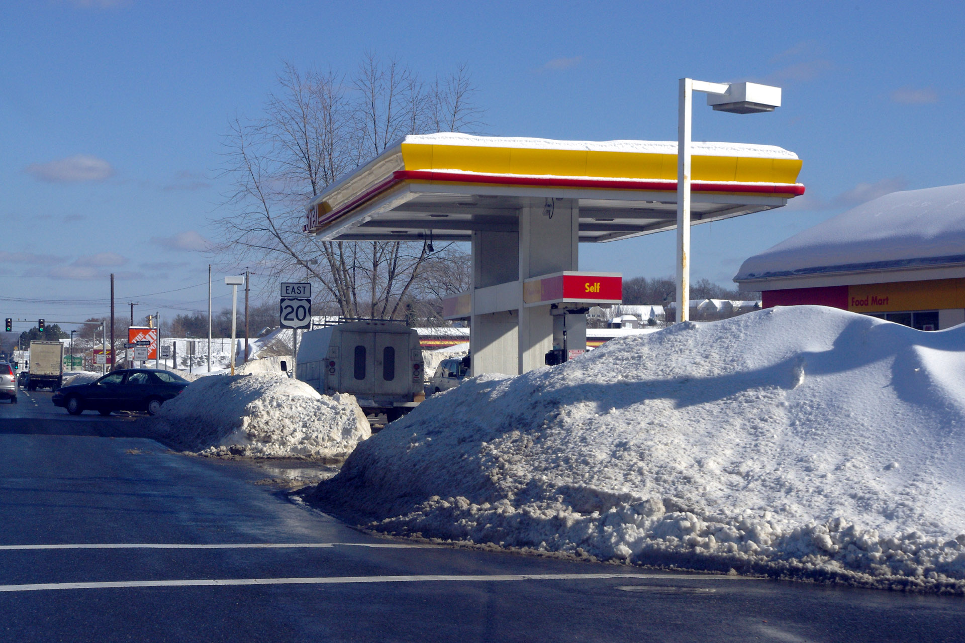 Winter 2010-2011 Snoe piles at the Shell station.
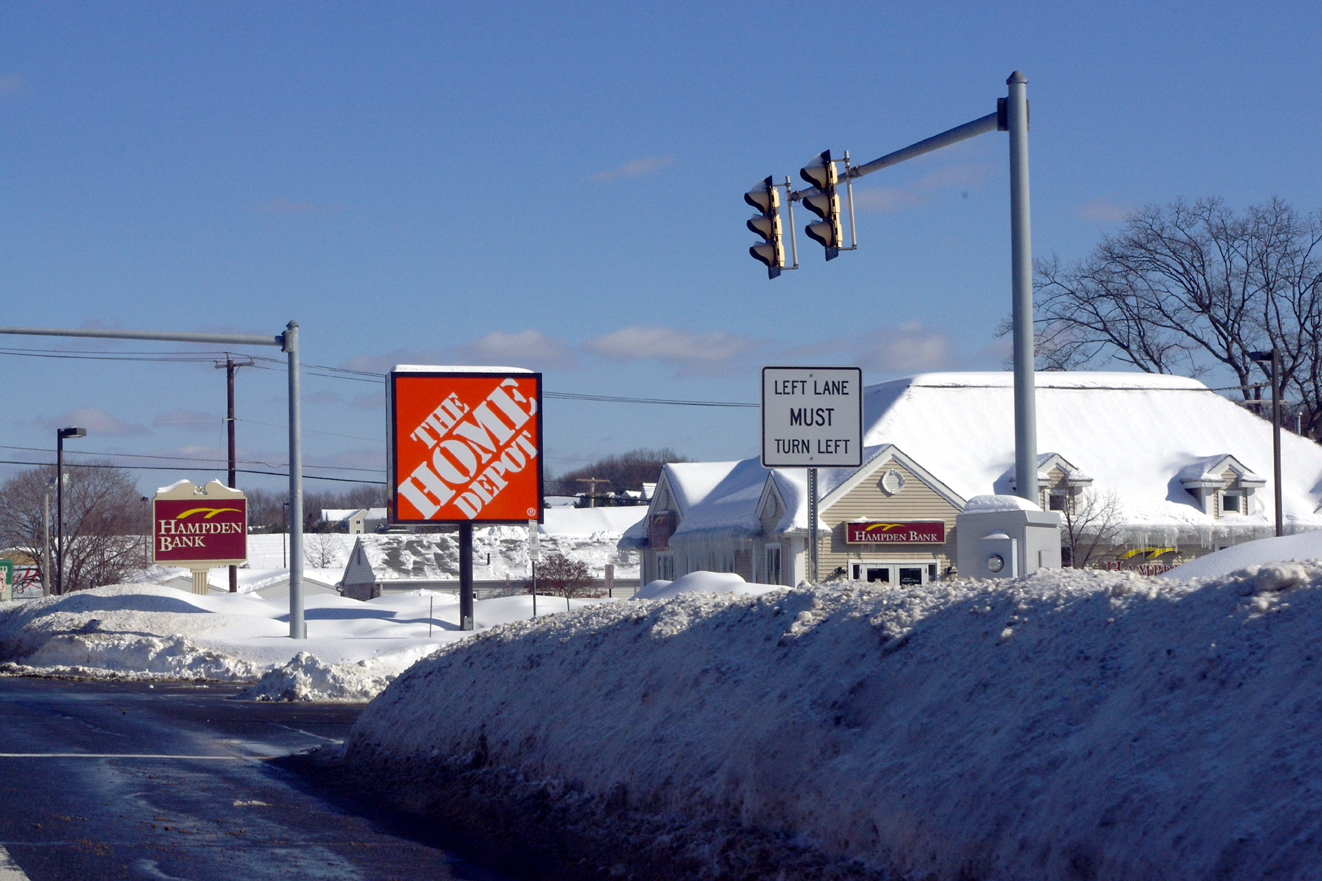 Winter 2010-2011 Snow piles near Home Depot.
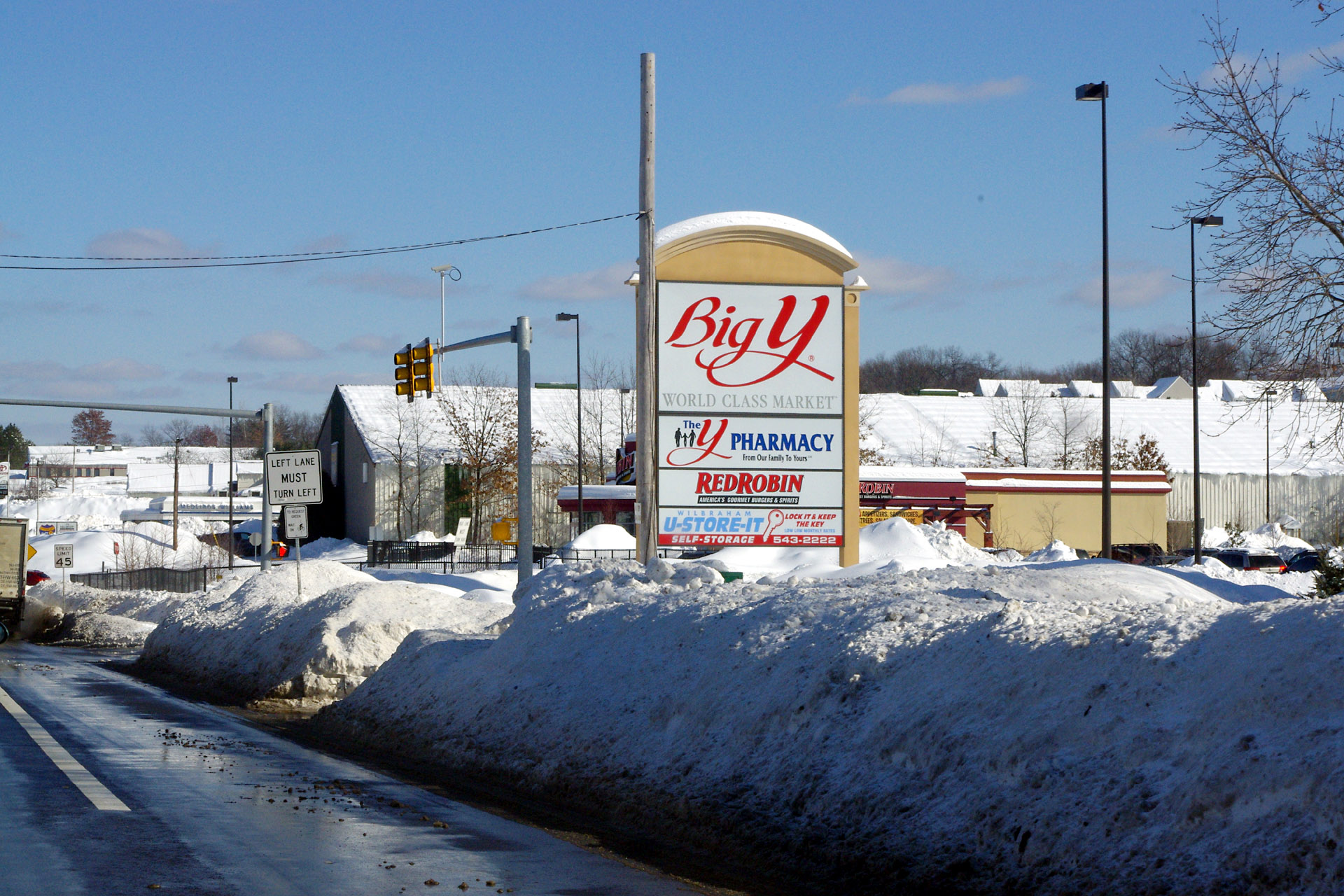 Winter 2010-2011 Snow piles near Big Y.
 Winter 2010-2011 Interskate 91.
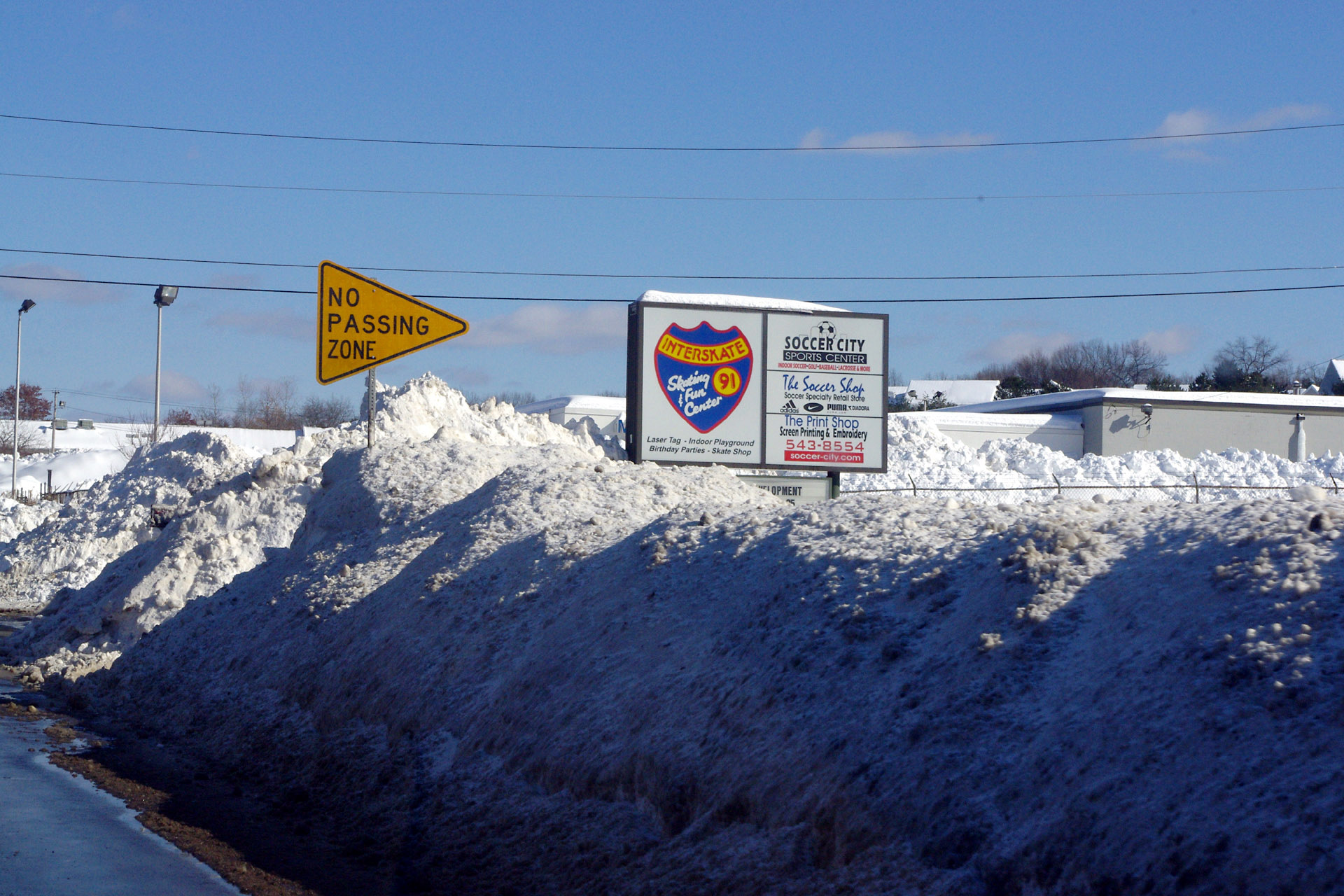 Winter 2010-2011 Interskate 91 (note how high the snow is compared to the No Passing sign).
 Winter 2010-2011 Snow piles along Boston Rd.
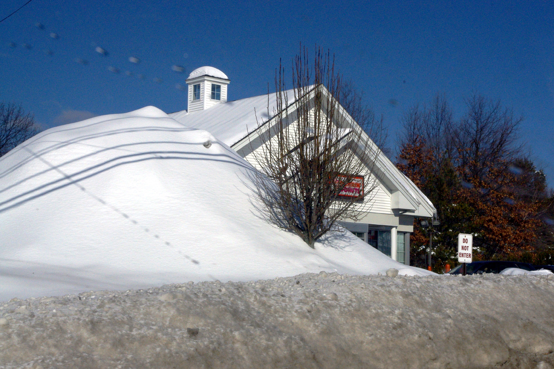 Winter 2010-2011 Dunkin Donuts almost hidden by a snow mountain.
 Winter 2010-2011 Looking east from just west of Old Boston Rd.
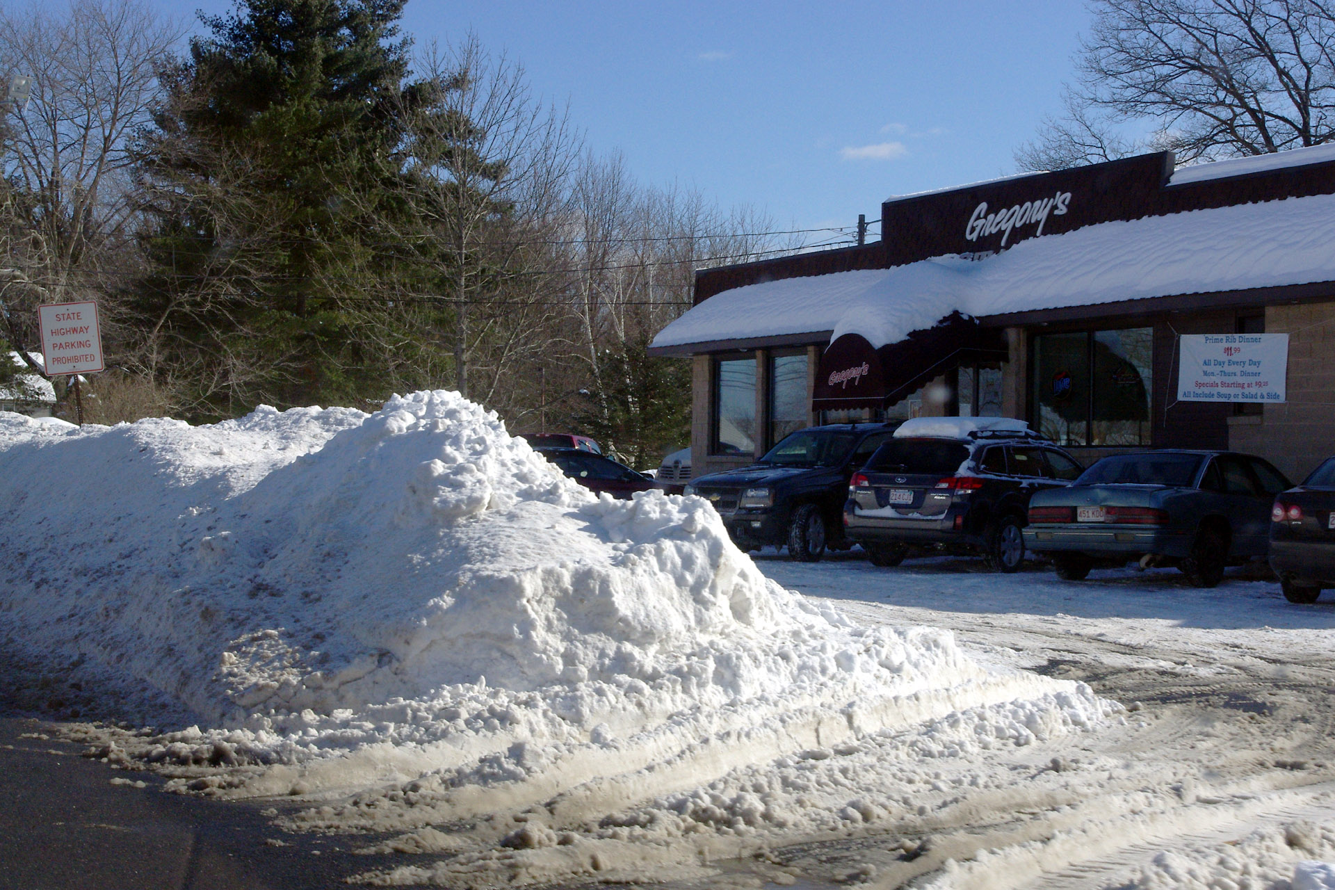 Winter 2010-2011 Snow piles at Gregory's Resaurant.
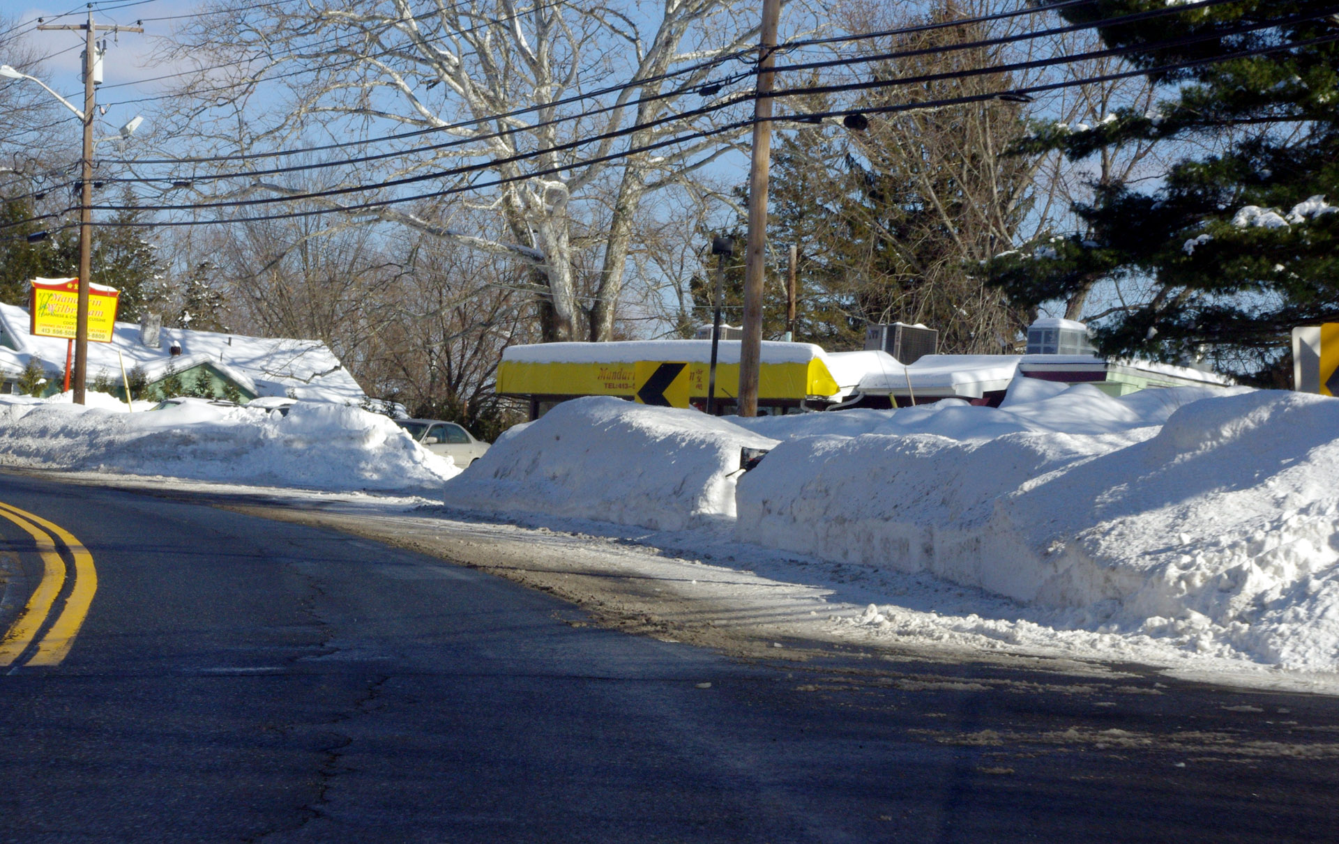 Winter 2010-2011 A view of Boston Road near the Mandarin.
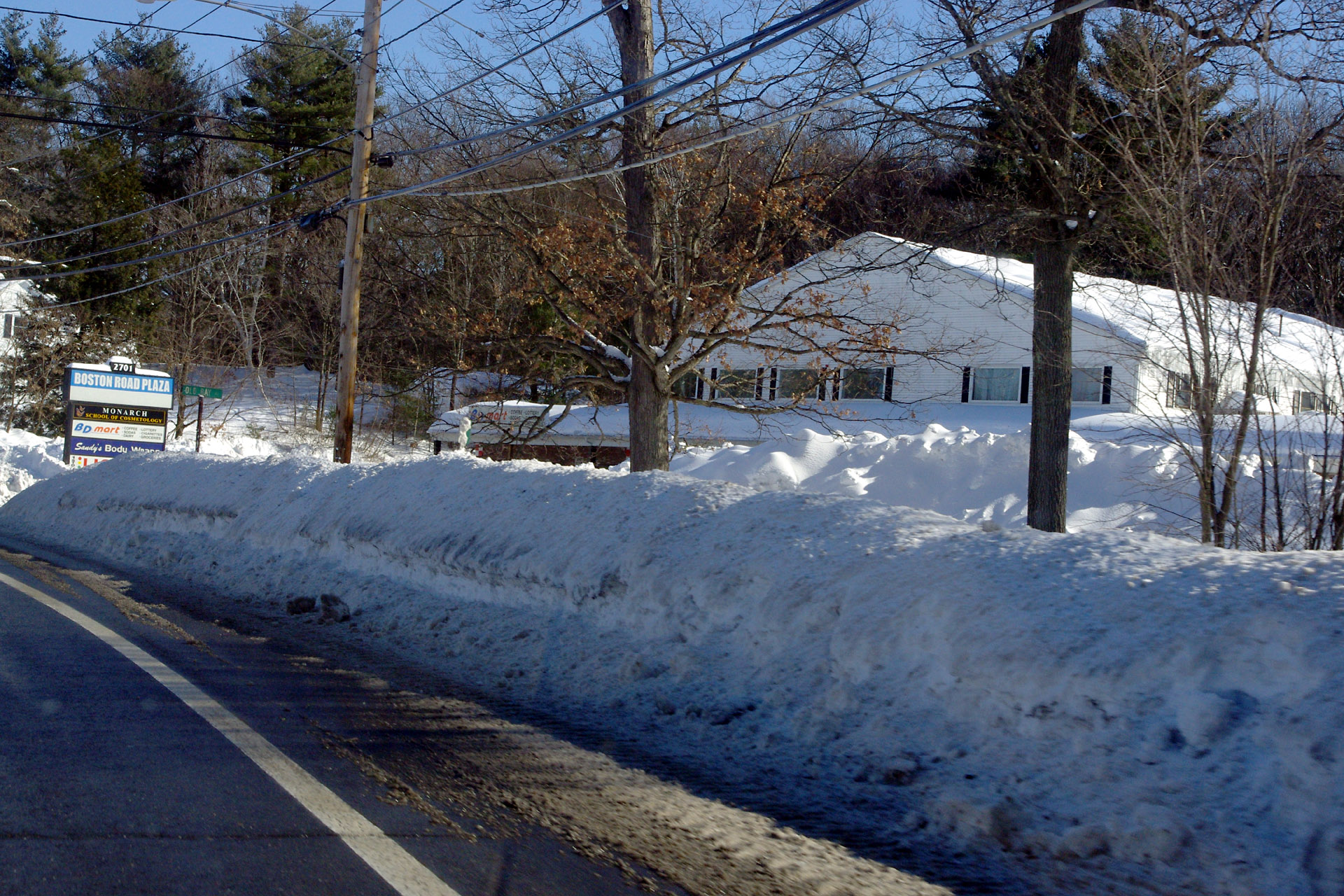 Winter 2010-2011 Snow piles across from the old dump.
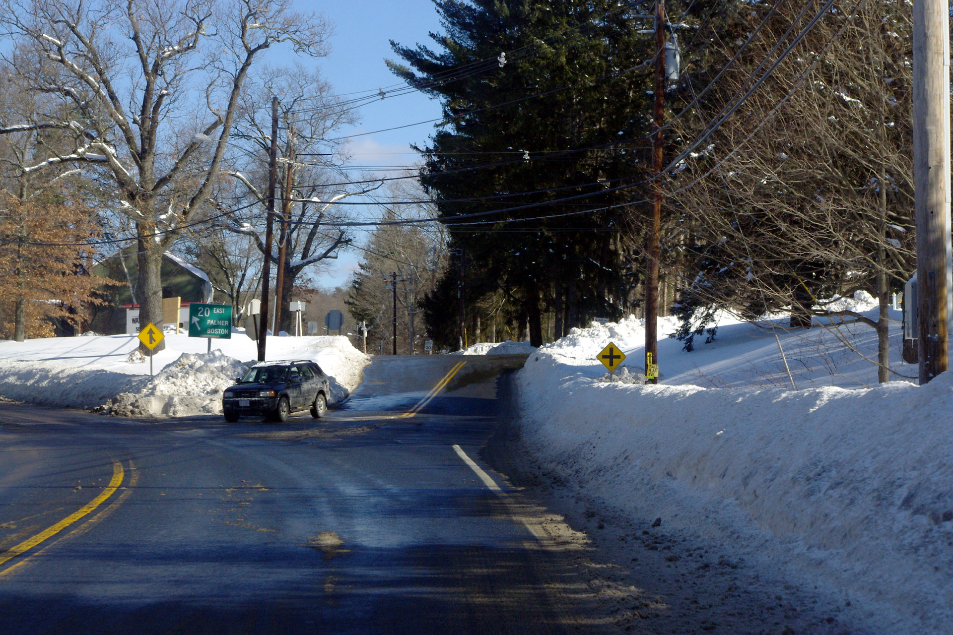 Winter 2010-2011 A view of the ramp up to Mountain Rd from Boston Rd.
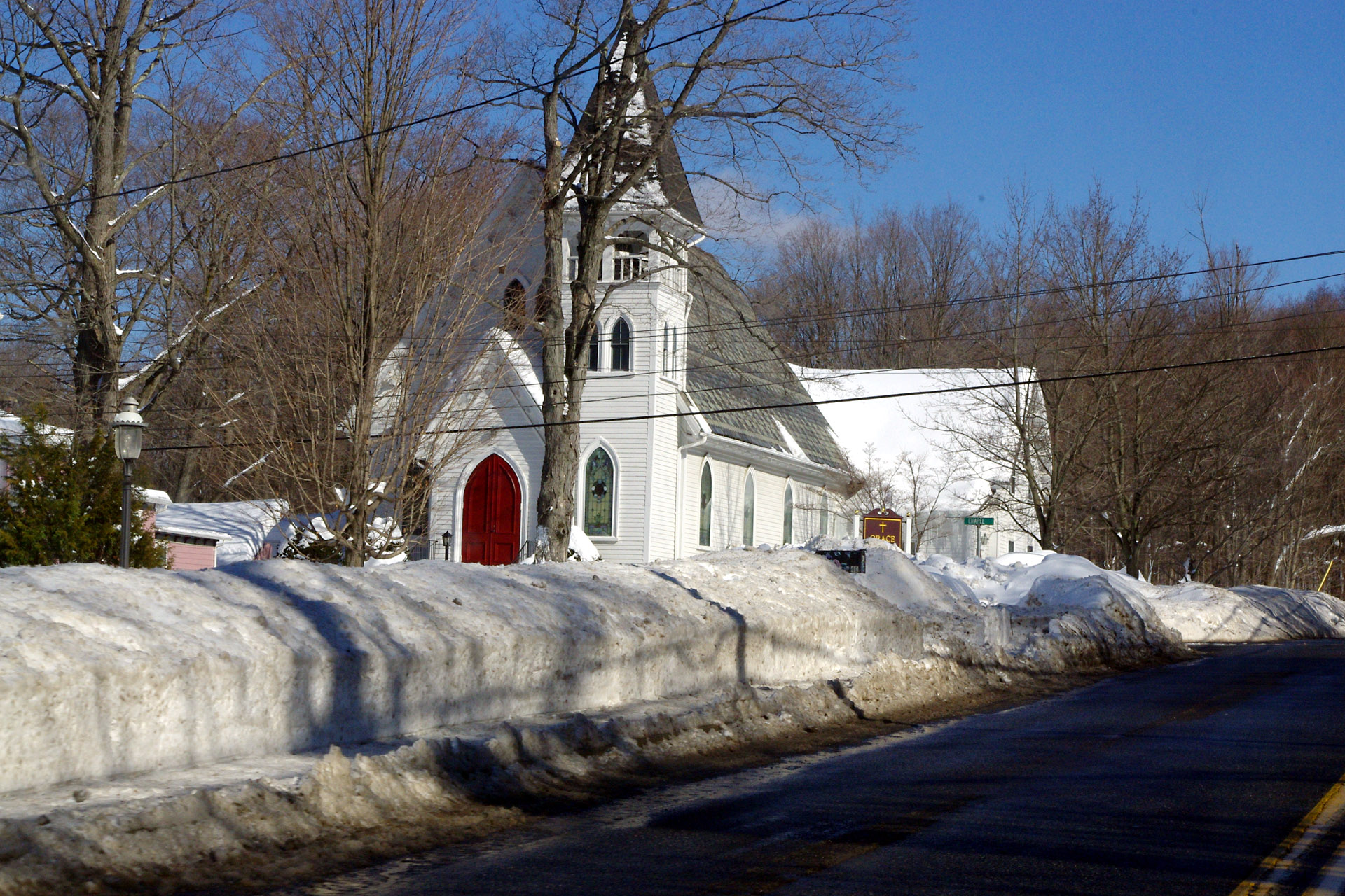 Winter 2010-2011 Grace Union Church.
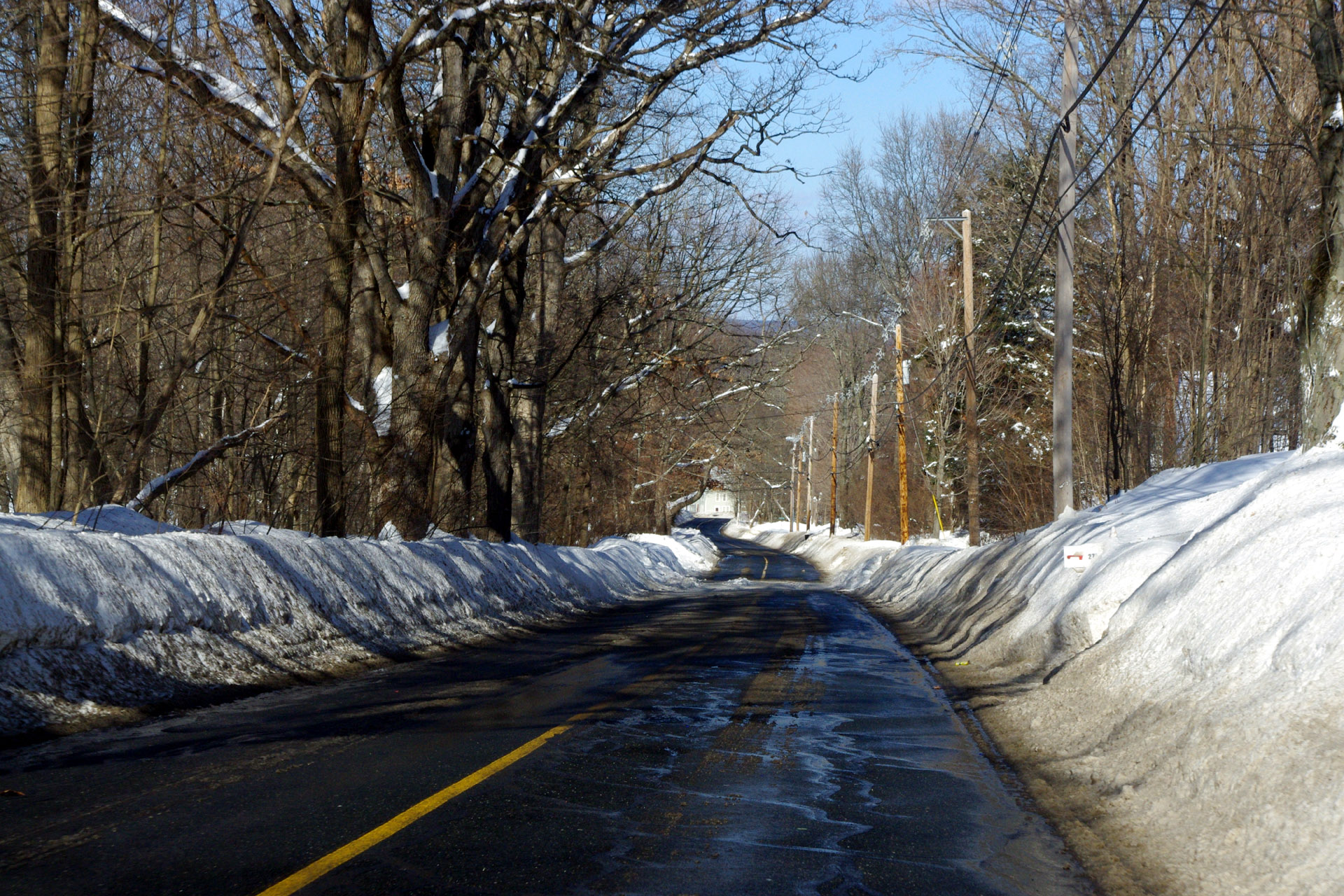
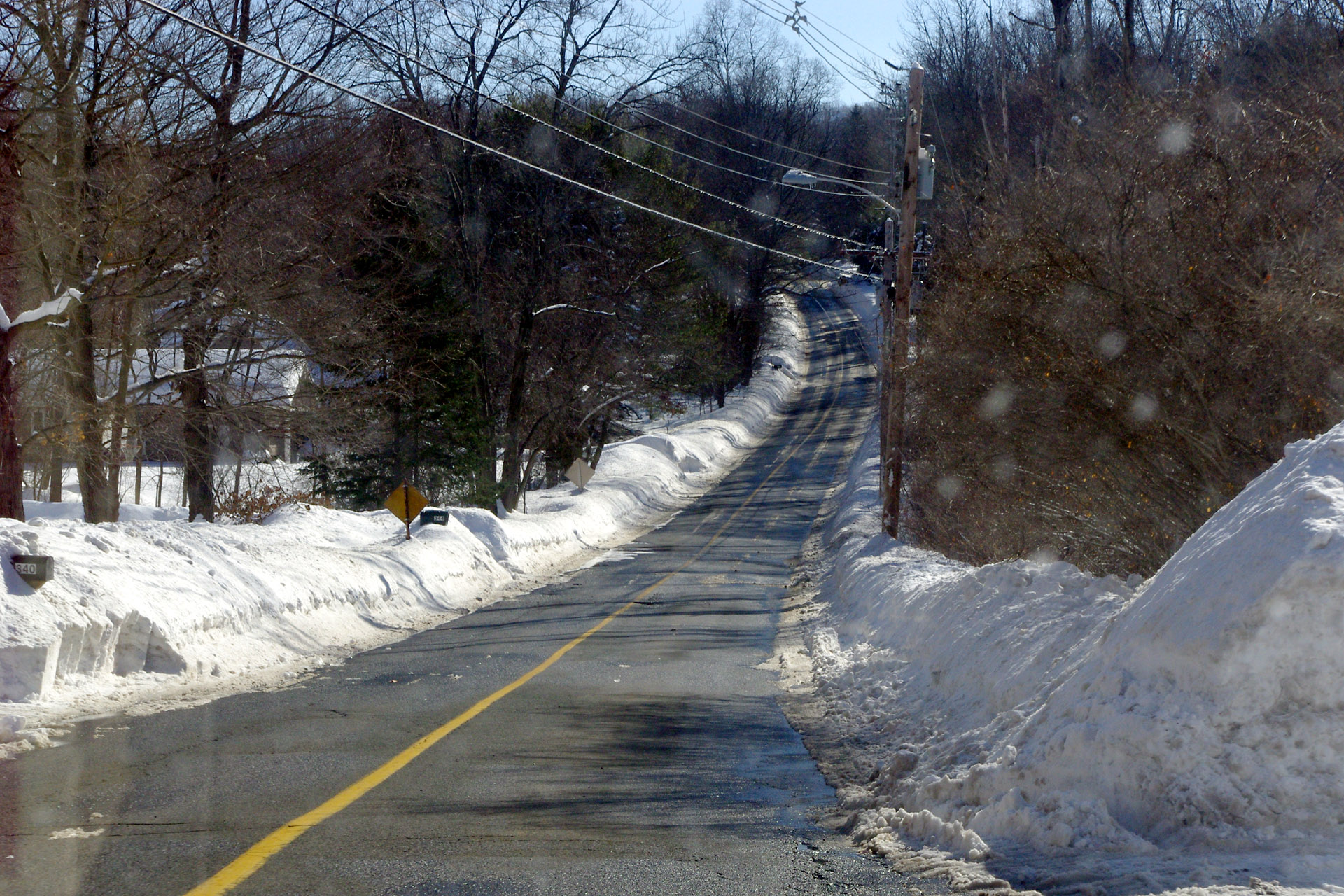
 Winter 2010-2011 A view of Mountain Rd about between the two Bartlett Avenue entrances.
 Winter 2010-2011 Looking up Mountain Rd from just north of Sunset Rock Rd.
 Winter 2010-2011 Looking up Mountain Rd from just south of Glendale Rd.
More photos coming!